Aviva
Aviva is an insurance on Ballybrit Business Park in Galway, County Galway, 3.4 km north-east of Eyre Square. Opentext, DXC.technology and Hewlett Packard Enterprise are within 21 m.
- Kind
- Insurance
- Street
- Ballybrit Business Park
- From Eyre Square
- 3.4 km north-east
- Wheelchair
- Accessible
- Bus stop
- Hewlett Packard (Bus Éireann), 80 m away
The map does not yet record a phone number, a website or opening hours for Aviva. Anyone can add them on OpenStreetMap; this page picks the change up at the next refresh.
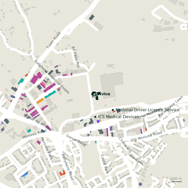
Plan of the surrounding 300 m
Getting to Aviva
- By bus
- The nearest stop is Hewlett Packard, served by Bus Éireann, 80 m away, with a shelter.
- Directions from where you are
- Open the model above, tap the pin and choose “Directions here”; the route is drawn from your own position.
While you are there
2 places to eat and drink within 300 m: Ed's Place (244 m) and Cruinniú (254 m).
2 shops within 300 m, including Centra and ACAL Technologies.
Ballybrit Business Park itself has 26 named places on the map, and 1 car park along it.
Within a short walk
- Opentext14 mIT companies
- DXC.technology15 mIT companies
- Hewlett Packard Enterprise21 mCompanies
- ICS Medical Devices220 mLaboratory
- National Driver Licence Service236 mCompanies
- Ed's Place244 mCafés
Also on Ballybrit Business Park
- ArupEngineers
- CeltrakCompanies
- Chermas Furniture LogitsticsCompanies
- Connolly's HyundaiCar dealers
- CruinniúCafés
- DXC.technologyIT companies
- Ed's PlaceCafés
Everything on Ballybrit Business Park (26 places)
Other insurance in Galway
- Faith Fahy Insurance386 mGlenrock Business Park
- Clearys Loss Assessors & Insurance650 mBóthar Na Míne
- 1.2 km
- O'Leary Insurance Group1.9 kmTuam Road
- Hooper Dolan Insurances1.9 kmTuam Road
- Murray and Spelman2.1 kmGalway Financial Services Centre
- FBD Insurance2.4 kmSean Mulvoy Road
- Mapfre Assistance3.3 kmProspect Hill
Questions people ask
Where is Aviva?
Are there other insurance nearby?
Source record: OpenStreetMap node/10157067400, read on 2026-09-18. The street is the mapped address where there is one, otherwise the nearest named road. Distances are straight lines.