Hooper Dolan Insurances
Hooper Dolan Insurances is an insurance on Tuam Road in Galway, County Galway, 1.7 km north-east of Eyre Square. Car Parts Warehouse, Knitwits & Crafty Stitchers and Mocha Beans are within 16 m.
The map does not yet record a phone number, a website or opening hours for Hooper Dolan Insurances. Anyone can add them on OpenStreetMap; this page picks the change up at the next refresh.
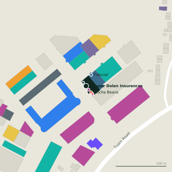
Plan of the surrounding 300 m
Getting to Hooper Dolan Insurances
- By bus
- The nearest stop is Tuam Road, served by Bus Éireann, 201 m away, with a shelter.
- Directions from where you are
- Open the model above, tap the pin and choose “Directions here”; the route is drawn from your own position.
While you are there
7 places to eat and drink within 300 m: Mocha Beans (16 m), COCO Café (49 m), O'Briens (73 m) and Bare Pantry cafe (82 m) and more.
18 shops within 300 m, including Knitwits & Crafty Stitchers, Suit Republic and David E. Menswear.
Tuam Road itself has 101 named places on the map.
Within a short walk
- Car Parts Warehouse9 mGarages
- Knitwits & Crafty Stitchers9 mCraft shops
- Mocha Beans16 mCafés
- Belle Hair20 mHairdressers
- Fiducial24 mAccountants
- Discover Chiropractic29 mAlternative
- C.P.H Tool & Pleant Hire30 mTool hire
- Suit Republic36 mClothes shops
Also on Tuam Road
- Ability WestCharity shops
- Ace PrintersPrinter ink
- African Pride StoreConvenience stores
- AIBCash machines
- All 4 BabyBaby goods
- ApplegreenPetrol stations
- Atlantic Print & DesignCopyshop
- Bank of IrelandCash machines
Everything on Tuam Road (101 places)
Other insurance in Galway
- O'Leary Insurance Group70 mTuam Road
- Murray and Spelman432 mGalway Financial Services Centre
- FBD Insurance591 mSean Mulvoy Road
- Clearys Loss Assessors & Insurance1.3 kmBóthar Na Míne
- Mapfre Assistance1.5 kmProspect Hill
- Faith Fahy Insurance1.6 kmGlenrock Business Park
- AXA1.6 kmBóthar Irwin
- Champion Insurance1.9 kmMerchants Road
Questions people ask
Where is Hooper Dolan Insurances?
Are there other insurance nearby?
Source record: OpenStreetMap node/8839012881, read on 2026-09-18. The street is the mapped address where there is one, otherwise the nearest named road. Distances are straight lines.