Cash machines · Upper Salthill Road · Galway
Bank of Ireland
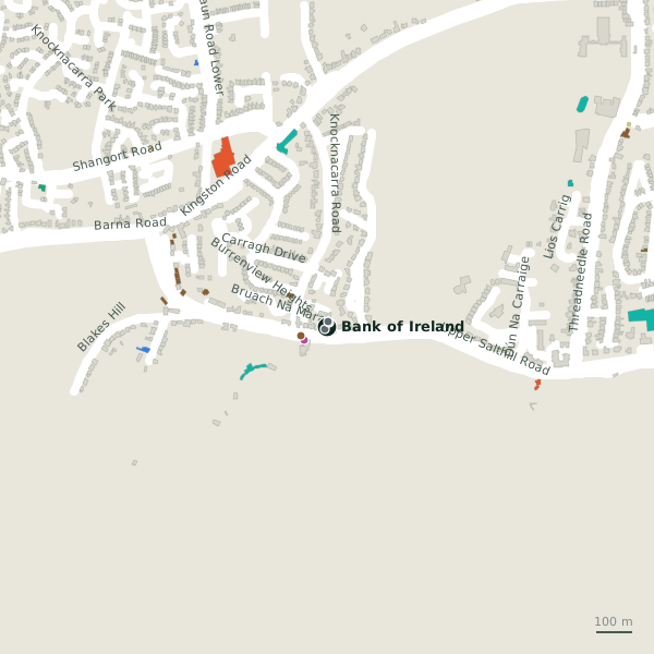
Bank of Ireland is a cash machine on Upper Salthill Road in Galway, County Galway, 3.9 km south-west of Eyre Square. Inver, XL and E. O’Farrell Auto Repair & Servicing are within 15 m.
- Kind
- Cash machines
- Street
- Upper Salthill Road
- From Eyre Square
- 3.9 km south-west
- Run by
- Bank of Ireland
- Bus stop
- Knocknacarra Rd (Burren View Hts) (Bus Éireann), 136 m away
The map does not yet record a phone number, a website or opening hours for Bank of Ireland. Anyone can add them on OpenStreetMap; this page picks the change up at the next refresh.
The building in black is this one; drag to turn the model.Open the whole town
Plan of the surrounding 300 m
Getting to Bank of Ireland
- By bus
- The nearest stop is Knocknacarra Rd (Burren View Hts), served by Bus Éireann, 136 m away, with a shelter.
- Directions from where you are
- Open the model above, tap the pin and choose “Directions here”; the route is drawn from your own position.
While you are there
2 shops within 300 m, including XL and Blackrock Cottage Pantry.
Upper Salthill Road itself has 70 named places on the map.
Within a short walk
- Inver7 mPetrol stations
- XL13 mConvenience stores
- 15 m
- 72 m
- O'Hallorans Caravan Park77 mCaravan parks
- JWT Cruises78 mTravel agency
- Marian Lodge130 mGuest houses
- Yoga Darśana205 mGyms
Also on Upper Salthill Road
- AIBBanks
- Andrea ConcannonOpticians
- Baily Point PhysiotherapyPhysiotherapist
- Bank of IrelandCash machines
- Bayview Holiday ParkCaravan parks
- BeaconPubs
- Black CatRestaurants
Everything on Upper Salthill Road (70 places)
Other cash machines in Galway
- 565 m
- Euronet1.4 kmUpper Salthill Road
- 1.7 km
- Bank of Ireland1.7 kmUpper Salthill Road
- Euronet2.5 kmFather Griffin Road
- 2.6 km
- 2.9 km
- AIB2.9 kmCrescent Court
Questions people ask
Where is Bank of Ireland?
On Upper Salthill Road in Galway, 3.9 km south-west of Eyre Square.
Are there other cash machines nearby?
24 other cash machines in $Galway; the closest is Brinks, 565 m away.
Source record: OpenStreetMap node/8960634477, read on 2026-09-18. The street is the mapped address where there is one, otherwise the nearest named road. Distances are straight lines.