Bank of Ireland
Bank of Ireland is a cash machine on Upper Salthill Road in Galway, County Galway, 2.3 km south-west of Eyre Square. Trend’s, Mocha Beans and BoyleSports are within 27 m.
- Kind
- Cash machines
- Street
- Upper Salthill Road
- From Eyre Square
- 2.3 km south-west
- Run by
- Bank of Ireland
- Parking
- National Aquarium Car Park on Seapoint Promenade, 152 m away
- Bus stop
- Salthill Church (Bus Éireann), 34 m away
The map does not yet record a phone number, a website or opening hours for Bank of Ireland. Anyone can add them on OpenStreetMap; this page picks the change up at the next refresh.
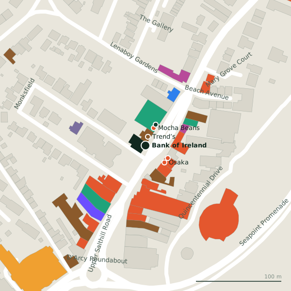
Plan of the surrounding 300 m
Getting to Bank of Ireland
- By car
- Park at National Aquarium Car Park on Seapoint Promenade, 152 m away, free, 27 spaces.
- By bus
- The nearest stop is Salthill Church, served by Bus Éireann, 34 m away.
- Directions from where you are
- Open the model above, tap the pin and choose “Directions here”; the route is drawn from your own position.
While you are there
27 places to eat and drink within 300 m: Trend’s (11 m), Mocha Beans (22 m), Osaka (29 m) and Subway (30 m) and more.
9 shops within 300 m, including Salthill Launderette, Fancy Fare and Shannon Dry Cleaners.
Upper Salthill Road itself has 70 named places on the map.
Within a short walk
- Trend’s11 mPubs
- Mocha Beans22 mCafés
- BoyleSports27 mBookmaker
- Osaka29 mRestaurants
- Subway30 mTakeaways
- Da Roberta’s31 mRestaurants
- Davitt Photo Centre32 mPhoto
- Top Fade Turkish barber32 mHairdressers
Also on Upper Salthill Road
- AIBBanks
- Andrea ConcannonOpticians
- Baily Point PhysiotherapyPhysiotherapist
- Bank of IrelandCash machines
- Bayview Holiday ParkCaravan parks
- BeaconPubs
- Black CatRestaurants
Everything on Upper Salthill Road (70 places)
Other cash machines in Galway
- Euronet388 mUpper Salthill Road
- Euronet939 mFather Griffin Road
- AIB1.2 kmCrescent Court
- 1.7 km
- Bank of Ireland1.7 kmUpper Salthill Road
- 1.8 km
- 2.0 km
- 2.1 km
Questions people ask
Where is Bank of Ireland?
Are there other cash machines nearby?
Source record: OpenStreetMap node/1760050180, read on 2026-09-18. The street is the mapped address where there is one, otherwise the nearest named road. Distances are straight lines.