Convenience stores · Castlelawn Heights · Galway
Castlelawn Heights
Castlelawn Heights is a convenience store on Castlelawn Heights in Galway, County Galway, 1.4 km north of Eyre Square. Menlo Park Hotel, Sweeney Oil and Point Bar are within 216 m.
- Street
- Castlelawn Heights
- From Eyre Square
- 1.4 km north
- Bus stop
- Stop (Bus Éireann), 106 m away
The map does not yet record a phone number, a website or opening hours for Castlelawn Heights. Anyone can add them on OpenStreetMap; this page picks the change up at the next refresh.
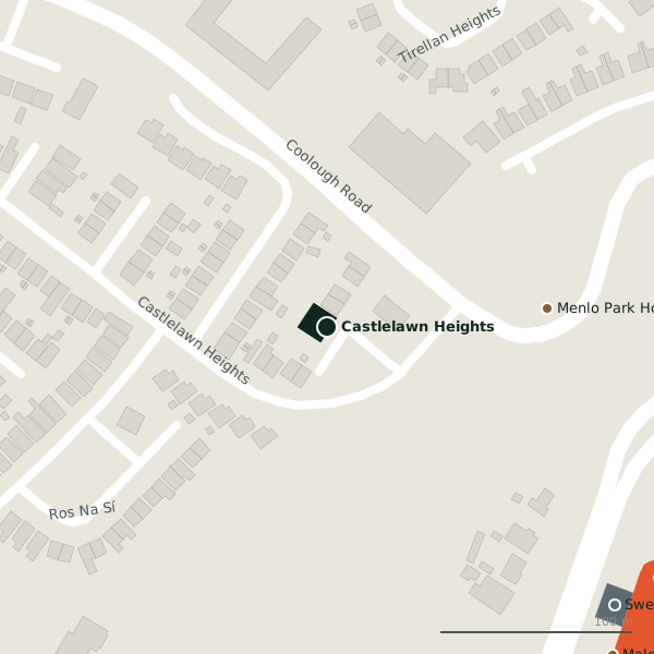
The building in black is this one; drag to turn the model.Open the whole town
Plan of the surrounding 300 m
Getting to Castlelawn Heights
- By bus
- The nearest stop is an unnamed stop, served by Bus Éireann, 106 m away, with a shelter.
- Directions from where you are
- Open the model above, tap the pin and choose “Directions here”; the route is drawn from your own position.
While you are there
3 places to eat and drink within 300 m: Point Bar (217 m), Olive Tree Bistro (236 m) and Apache Pizza (252 m).
7 shops within 300 m, including Spar, Super Asia and Paul Kearney Cycles.
Within a short walk
- Menlo Park Hotel115 mHotels
- Sweeney Oil208 mPetrol stations
- Point Bar216 mBars
- 226 m
- Spar226 mConvenience stores
- Olive Tree Bistro236 mRestaurants
- Sheils Motor Group247 mCar dealers
- Super Asia248 mSupermarkets
Other convenience stores in Galway
- Spar226 mHeadford Road
- Paper Chase424 mHeadford Road
- African Pride Store748 mTuam Road
- Moldova812 mTuam Road
- Polonez968 mTuam Road
- Tesco Express995 mHeadford Road
- Armazém Brazil1.2 kmProspect Hill
- Student's Union Shop1.2 kmLower Newcastle Road
Questions people ask
Where is Castlelawn Heights?
On Castlelawn Heights in Galway, 1.4 km north of Eyre Square.
Are there other convenience stores nearby?
81 other convenience stores in $Galway; the closest is Spar, 226 m away.
Source record: OpenStreetMap node/1121993461, read on 2026-09-18. The street is the mapped address where there is one, otherwise the nearest named road. Distances are straight lines.