Spar
Spar is a convenience store on Headford Road in Galway, County Galway, 1.3 km north of Eyre Square. Olive Tree Bistro, Point Bar and Sweeney Oil are within 25 m.
- Street
- Headford Road
- From Eyre Square
- 1.3 km north
- Parking
- Dyke Road Car Park on Dyke Road, 970 m away
- Bus stop
- Bus Stop [ID:524091] (Bus Éireann), 96 m away
The map does not yet record a phone number, a website or opening hours for Spar. Anyone can add them on OpenStreetMap; this page picks the change up at the next refresh.
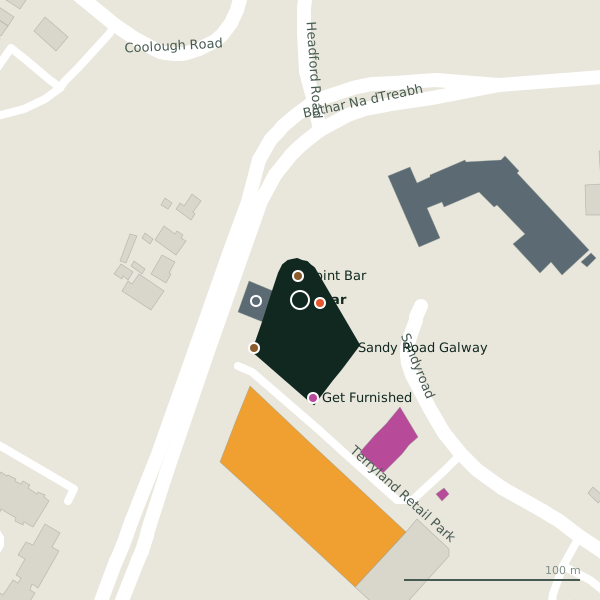
Plan of the surrounding 300 m
Getting to Spar
- By car
- Park at Dyke Road Car Park on Dyke Road, 970 m away, paid.
- By bus
- The nearest stop is Bus Stop [ID:524091], served by Bus Éireann, 96 m away, with a shelter.
- Directions from where you are
- Open the model above, tap the pin and choose “Directions here”; the route is drawn from your own position.
While you are there
4 places to eat and drink within 300 m: Olive Tree Bistro (11 m), Point Bar (14 m), Apache Pizza (74 m) and O'Hehirs Bakery & Cafe (220 m).
17 shops within 300 m, including Get Furnished, Super Asia and Keane's Florist.
Headford Road itself has 97 named places on the map, and 1 car park along it.
Within a short walk
- Olive Tree Bistro11 mRestaurants
- Point Bar14 mBars
- Sweeney Oil25 mPetrol stations
- 37 m
- Get Furnished56 mFurniture
- Super Asia62 mSupermarkets
- Keane's Florist67 mFlorists
- Apache Pizza74 mTakeaways
Also on Headford Road
- 3 StorePhone shops
- ÁlainnCafés
- AldiSupermarkets
- An Mheitheal RotharBike shops
- Ballindooly CastleCastles
- BellissimoHairdressers
- BestDriveGarages
- BodkinBike hire
Everything on Headford Road (97 places)
Other convenience stores in Galway
- Castlelawn Heights226 mCastlelawn Heights
- Paper Chase272 mHeadford Road
- African Pride Store580 mTuam Road
- Moldova622 mTuam Road
- Polonez786 mTuam Road
- Tesco Express1.0 kmHeadford Road
- Armazém Brazil1.1 kmProspect Hill
- Woodquay Stores1.2 kmWoodquay
Questions people ask
Where is Spar?
Are there other convenience stores nearby?
Source record: OpenStreetMap way/586572963, read on 2026-09-18. The street is the mapped address where there is one, otherwise the nearest named road. Distances are straight lines.