Coyotes
Coyotes is a bar on Shop Street in Galway, County Galway, 308 m south-west of Eyre Square. Holland & Barrett, Eason and Boots are within 11 m.
- Kind
- Bars
- Street
- 34 Shop Street
- From Eyre Square
- 308 m south-west
- Website
- coyotes.ie
- Wheelchair
- Not accessible
- Parking
- Market Street Car Park on Bowling Green, 112 m away
- Bus stop
- Franciscan Friary (Bus Éireann;City Direct), 254 m away
The map does not yet record a phone number or opening hours for Coyotes. Anyone can add them on OpenStreetMap; this page picks the change up at the next refresh.
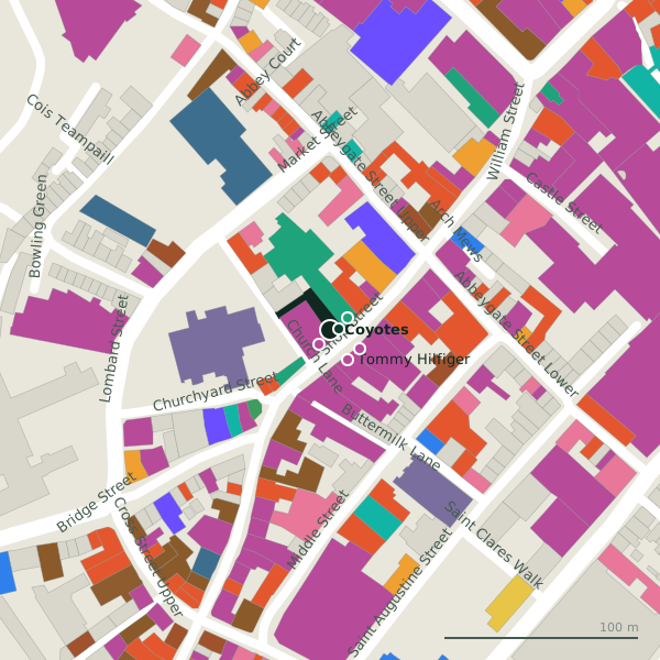
Plan of the surrounding 300 m
Getting to Coyotes
- By car
- Park at Market Street Car Park on Bowling Green, 112 m away, paid, 83 spaces.
- By bus
- The nearest stop is Franciscan Friary, served by Bus Éireann;City Direct, 254 m away.
- Directions from where you are
- Open the model above, tap the pin and choose “Directions here”; the route is drawn from your own position.
While you are there
133 places to eat and drink within 300 m: McDonald's (21 m), 56 Central (39 m), Cafe Express (40 m) and Prátaí (45 m) and more.
145 shops within 300 m, including Eason, Tommy Hilfiger and VILA.
Shop Street itself has 26 named places on the map.
Within a short walk
- Holland & Barrett4 mHealth food
- Eason10 mBookshops
- Boots11 mPharmacies
- Tommy Hilfiger18 mClothes shops
- VILA18 mClothes shops
- Brennans20 mShoe shops
- McDonald's21 mTakeaways
- River Island22 mClothes shops
Also on Shop Street
- 3 StorePhone shops
- 56 CentralRestaurants
- AIBBanks
- Anthony RyansClothes shops
- BootsPharmacies
- BrennansShoe shops
- Cafe ExpressCafés
- Dubray BooksBookshops
Everything on Shop Street (26 places)
Other bars in Galway
- Tigh Nora149 mCross Street Upper
- The Kasbah Wine Bar185 mQuay Street
- The Lane Wine and Cheese188 mKirwan's Lane
- Buddha Bar192 mMary Street
- M. Fitzgerald’s217 mQuay Street
- La Viña260 mQuay Lane
- Daróg329 mDominick Street Lower
- The Oyster Bar337 mEyre Square
Questions people ask
Where is Coyotes?
Are there other bars nearby?
Source record: OpenStreetMap node/4261498091, read on 2026-09-18. The street is the mapped address where there is one, otherwise the nearest named road. Distances are straight lines.