Tigh Nora
Tigh Nora is a bar on Cross Street Upper in Galway, County Galway, 452 m south-west of Eyre Square. Street Dog, The Front Door and Cavavin are within 12 m.
- Kind
- Bars
- Street
- 6 Cross Street Upper
- From Eyre Square
- 452 m south-west
- Website
- tighnoragalway.com
- Wheelchair
- Accessible
- Parking
- Spanish Arch Car Park on Kirwan's Lane, 97 m away
- Bus stop
- Jury's Hotel (Bus Éireann), 133 m away
The map does not yet record a phone number or opening hours for Tigh Nora. Anyone can add them on OpenStreetMap; this page picks the change up at the next refresh.
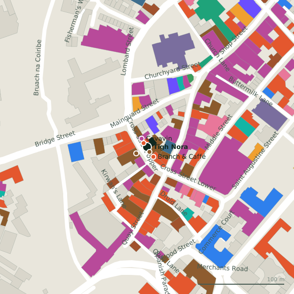
Plan of the surrounding 300 m
Getting to Tigh Nora
- By car
- Park at Spanish Arch Car Park on Kirwan's Lane, 97 m away, paid.
- By bus
- The nearest stop is Jury's Hotel, served by Bus Éireann, 133 m away.
- Directions from where you are
- Open the model above, tap the pin and choose “Directions here”; the route is drawn from your own position.
While you are there
111 places to eat and drink within 300 m: Street Dog (6 m), The Front Door (6 m), Branch & Caffé (14 m) and Busker Browne’s (15 m) and more.
101 shops within 300 m, including Cavavin, Tempo Antiques and Nelly.
Cross Street Upper itself has 15 named places on the map, and 1 car park along it.
Within a short walk
- Street Dog6 mTakeaways
- The Front Door6 mPubs
- Cavavin12 mOff licences
- Branch & Caffé14 mCafés
- Busker Browne’s14 mPubs
- 7 Boutique15 mHotels
- Tempo Antiques17 mAntiques
- Kirby's18 mRestaurants
Also on Cross Street Upper
- 7 BoutiqueHotels
- AvenueCafés
- Branch & CafféCafés
- Busker Browne’sPubs
- CavavinOff licences
- Kirby'sRestaurants
- NellyClothes shops
- Pizza NapoliTakeaways
Everything on Cross Street Upper (15 places)
Other bars in Galway
- The Lane Wine and Cheese39 mKirwan's Lane
- The Kasbah Wine Bar46 mQuay Street
- M. Fitzgerald’s75 mQuay Street
- La Viña132 mQuay Lane
- Coyotes149 mShop Street
- Daróg193 mDominick Street Lower
- Buddha Bar308 mMary Street
- The Oyster Bar470 mEyre Square
Questions people ask
Where is Tigh Nora?
Are there other bars nearby?
Source record: OpenStreetMap node/9928081983, read on 2026-09-18. The street is the mapped address where there is one, otherwise the nearest named road. Distances are straight lines.