Cafés · Nimmo's Pier · Galway
Dolly's Coffee
Dolly's Coffee is a café on Nimmo's Pier in Galway, County Galway, 859 m south of Eyre Square. The kitchen is listed as coffee shop. Claddagh Playground, Frenchville House B&B and Saint Mary's Priory are within 197 m.
- Kind
- Cafés
- Street
- Nimmo's Pier
- From Eyre Square
- 859 m south
- Website
- taraking1997@gmail.com
- Wheelchair
- Accessible
- Parking
- Claddagh Church on Claddagh Quay, 178 m away
- Bus stop
- Fr Griffin Roa (Bus Éireann), 307 m away
The map does not yet record a phone number or opening hours for Dolly's Coffee. Anyone can add them on OpenStreetMap; this page picks the change up at the next refresh.
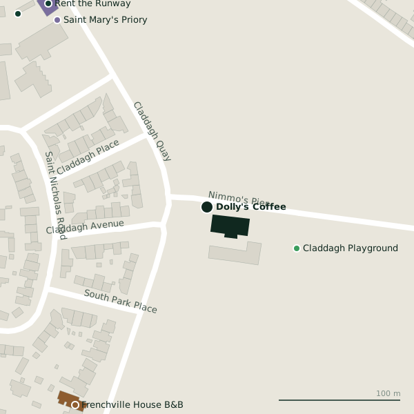
The building in black is this one; drag to turn the model.Open the whole town
Plan of the surrounding 300 m
Getting to Dolly's Coffee
- By car
- Park at Claddagh Church on Claddagh Quay, 178 m away, paid.
- By bus
- The nearest stop is Fr Griffin Roa, served by Bus Éireann, 307 m away, with a shelter.
- Directions from where you are
- Open the model above, tap the pin and choose “Directions here”; the route is drawn from your own position.
While you are there
1 place to eat or drink within 300 m: Ard Bia at Nimmo's (252 m).
Nimmo's Pier itself has 2 named places on the map.
Within a short walk
- Claddagh Playground81 mPlaygrounds
- Frenchville House B&B195 mGuest houses
- Saint Mary's Priory197 mChurches
- Rent the Runway211 mCompanies
- Galway Fire Station221 mFire station
Also on Nimmo's Pier
- Claddagh PlaygroundPlaygrounds
Other cafés in Galway
- Gourmet Tart Co.340 mRaven Terrace
- Starbucks398 mQuay Street
- Arabica Cafe402 mMerchants Road
- Anton's408 mFather Griffin Road
- An Tobar Nua419 mDominick Street Lower
- The Lane Cafe432 mDruid Lane
- PLÁMÁS437 mDominick Street Upper
- Mocha Beans439 mCross Street Lower
Questions people ask
Where is Dolly's Coffee?
On Nimmo's Pier in Galway, 859 m south of Eyre Square; the nearest car park is 178 m away.
Are there other cafés nearby?
105 other cafés in $Galway; the closest is Gourmet Tart Co., 340 m away.
Source record: OpenStreetMap node/13382366401, read on 2026-09-18. The street is the mapped address where there is one, otherwise the nearest named road. Distances are straight lines.