Dun Aoibhinn House B&B
Dun Aoibhinn House B&B is a hotel in the town in Galway, County Galway, 1.0 km west of Eyre Square. Coláiste Muire Máthair, Scoil Iognáid and 091 Labs are within 124 m.
- Kind
- Hotels
- From Eyre Square
- 1.0 km west
- Parking
- Free Parking on Gaol Road, 524 m away
- Bus stop
- Stop, 328 m away
The map does not yet record a phone number, a website or opening hours for Dun Aoibhinn House B&B. Anyone can add them on OpenStreetMap; this page picks the change up at the next refresh.
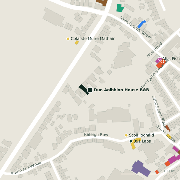
Plan of the surrounding 300 m
Getting to Dun Aoibhinn House B&B
- By car
- Park at Free Parking on Gaol Road, 524 m away.
- By bus
- The nearest stop is an unnamed stop, 328 m away.
- Directions from where you are
- Open the model above, tap the pin and choose “Directions here”; the route is drawn from your own position.
While you are there
16 places to eat and drink within 300 m: Hooked (147 m), Cooke’s Thatch Bar (165 m), Kai (201 m) and Woozza Pizza Takeaway (204 m) and more.
9 shops within 300 m, including Ali's Fish Market, Bell Book and Candle and Ernie's.
Within a short walk
- Coláiste Muire Máthair105 mSchools
- Scoil Iognáid109 mSchools
- 091 Labs124 mHackerspace
- Ali's Fish Market144 mFishmongers
- Hooked147 mRestaurants
- Order of Malta150 mSocial services
- Coláiste Iognáid158 mSchools
- Walter Macken House163 mMonuments
Other hotels in Galway
- Leonardo Hotel Galway522 mQuay Street
- Ward's Hotel542 mLower Salthill Road
- Residence Hotel585 mQuay Street
- 7 Boutique589 mCross Street Upper
- The Snug Townhouse596 mQuay Street
- The House Hotel675 mMerchants Road Lower
- The Continental Boutique Residence714 mLower Salthill Road
- The Abbeygate Townhouse716 mNewtownsmith
Questions people ask
Where is Dun Aoibhinn House B&B?
Are there other hotels nearby?
Source record: OpenStreetMap node/4408642452, read on 2026-09-18. The street is the mapped address where there is one, otherwise the nearest named road. Distances are straight lines.