Order of Malta
Order of Malta is a social service on Saint Helens Street in Galway, County Galway, 881 m west of Eyre Square. Moughans, George Conboy Electrical and Ali's Fish Market are within 72 m.
- Kind
- Social services
- Street
- Saint Helens Street
- From Eyre Square
- 881 m west
- Run by
- Order of Malta
- Parking
- Free Parking on Gaol Road, 375 m away
- Bus stop
- Stop, 181 m away
The map does not yet record a phone number, a website or opening hours for Order of Malta. Anyone can add them on OpenStreetMap; this page picks the change up at the next refresh.
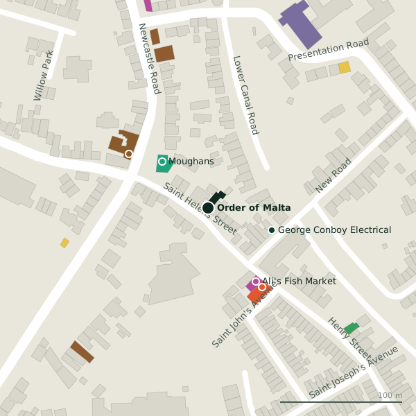
Plan of the surrounding 300 m
Getting to Order of Malta
- By car
- Park at Free Parking on Gaol Road, 375 m away.
- By bus
- The nearest stop is an unnamed stop, 181 m away.
- Directions from where you are
- Open the model above, tap the pin and choose “Directions here”; the route is drawn from your own position.
While you are there
20 places to eat and drink within 300 m: Cooke’s Thatch Bar (78 m), Hooked (78 m), Massimo (257 m) and The Crane Bar (257 m) and more.
10 shops within 300 m, including Ali's Fish Market, The Gourmet Offensive and Bell Book and Candle.
Within a short walk
- Moughans53 mPharmacies
- George Conboy Electrical55 mElectrical
- Ali's Fish Market72 mFishmongers
- 78 m
- Hooked78 mRestaurants
- Desota House Bed and Breakfast132 mGuest houses
- Coláiste Muire Máthair135 mSchools
- Mary Byrne Playground141 mPlaygrounds
Other social services in Galway
- Saint Mary's Residential Centre296 mShantalla Road
- Samaritans303 mNun's Island
- Fairgreen Homeless Men's Hostel1.1 kmFairgreen Road
- Osterley Lodge1.2 kmLower Salthill Road
- Galway Rape Crisis Centre1.2 kmForster Court
- St. Francis Primary & Daycare1.5 kmUpper Newcastle Road
- Glenoaks Hotel1.5 kmBishop O'Donnell Road
- Galway Centre for Independant Living2.1 kmTown Park Centre
Questions people ask
Where is Order of Malta?
Are there other social services nearby?
Source record: OpenStreetMap node/1867215904, read on 2026-09-18. The street is the mapped address where there is one, otherwise the nearest named road. Distances are straight lines.