St. Francis Primary & Daycare
St. Francis Primary & Daycare is a social service on Upper Newcastle Road in Galway, County Galway, 1.7 km north-west of Eyre Square. Croí West Of Ireland Cardiac Foundation, University of Galway - Central Campus and Cairnes Business School are within 149 m.
- Kind
- Social services
- Street
- Upper Newcastle Road
- From Eyre Square
- 1.7 km north-west
- Phone
- +353 91 861 100
- Run by
- Health Service Executive
- Parking
- Car Park 3, 767 m away
- Bus stop
- St, Francis Home (Bus Éireann), 69 m away
The map does not yet record a website or opening hours for St. Francis Primary & Daycare. Anyone can add them on OpenStreetMap; this page picks the change up at the next refresh.
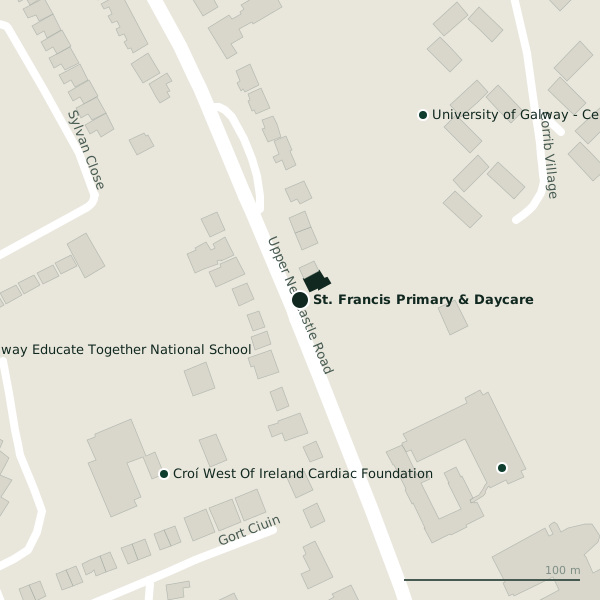
Plan of the surrounding 300 m
Getting to St. Francis Primary & Daycare
- By car
- Park at Car Park 3, 767 m away, paid.
- By bus
- The nearest stop is St, Francis Home, served by Bus Éireann, 69 m away.
- Directions from where you are
- Open the model above, tap the pin and choose “Directions here”; the route is drawn from your own position.
While you are there
1 place to eat or drink within 300 m: Zinc Cafe (294 m).
Upper Newcastle Road itself has 7 named places on the map, and 1 car park along it.
Within a short walk
- 125 m
- University of Galway - Central Campus126 mUniversities
- Cairnes Business School149 mUniversities
- 189 m
Also on Upper Newcastle Road
- Bank of IrelandCash machines
- CentraConvenience stores
- Corrib HavenGuest houses
- Kelehans BarPubs
- Saint James' ChurchChurches
- SparConvenience stores
Other social services in Galway
- Saint Mary's Residential Centre1.4 kmShantalla Road
- Order of Malta1.5 kmSaint Helens Street
- Samaritans1.5 kmNun's Island
- Glenoaks Hotel1.8 kmBishop O'Donnell Road
- Galway Rape Crisis Centre1.8 kmForster Court
- Fairgreen Homeless Men's Hostel1.9 kmFairgreen Road
- Galway Centre for Independant Living2.1 kmTown Park Centre
- Osterley Lodge2.4 kmLower Salthill Road
Questions people ask
Where is St. Francis Primary & Daycare?
How do I contact St. Francis Primary & Daycare?
Are there other social services nearby?
Source record: OpenStreetMap way/1081836197, read on 2026-09-18. The street is the mapped address where there is one, otherwise the nearest named road. Distances are straight lines.