Fisheries Field
Fisheries Field is a park on Earls Island in Galway, County Galway, 570 m north-west of Eyre Square. O'Shaughnessy Bridge, Macnas and Corrib House Tearooms are within 121 m.
- Kind
- Parks
- Street
- Earls Island
- From Eyre Square
- 570 m north-west
- Run by
- Inland Fisheries Ireland
- Parking
- Cathedral Car Park, 216 m away
- Bus stop
- Galway Cathedral (Bus Éireann;City Direct), 179 m away
The map does not yet record a phone number, a website or opening hours for Fisheries Field. Anyone can add them on OpenStreetMap; this page picks the change up at the next refresh.
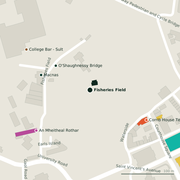
Plan of the surrounding 300 m
Getting to Fisheries Field
- By car
- Park at Cathedral Car Park, 216 m away, paid, 130 spaces.
- By bus
- The nearest stop is Galway Cathedral, served by Bus Éireann;City Direct, 179 m away.
- Directions from where you are
- Open the model above, tap the pin and choose “Directions here”; the route is drawn from your own position.
While you are there
7 places to eat and drink within 300 m: Corrib House Tearooms (121 m), College Bar - Sult (143 m), Brazco (265 m) and McGinn’s Hop House (265 m) and more.
6 shops within 300 m, including An Mheitheal Rothar, Woodquay Stores and Chime.
Earls Island itself has 2 named places on the map.
Other sites within 3 km: Salmon Weir Bridge (167 m), Zoology Museum (207 m), Woodquay Park (229 m), College Park (267 m) and The Plots (304 m).
Within a short walk
- O'Shaughnessy Bridge79 mBike hire
- Macnas97 mArts centres
- 121 m
- An Mheitheal Rothar127 mBike shops
- 142 m
- University of Galway - South Campus144 mUniversities
- Cathedral146 mBike hire
- 146 m
Also on Earls Island
- An Mheitheal RotharBike shops
Other parks around Galway
- Woodquay Park229 mRiverside
- College Park267 mUniversity Road
- The Plots304 mThe Plots Road
- Millennium Children's Park330 mUpper Canal Road
- 399 m
- Eyre Square537 mEyre Square
- 623 m
- Sliding Rock756 mColmans Road
Questions people ask
Where is Fisheries Field?
Are there other parks nearby?
Source record: OpenStreetMap way/115749484, read on 2026-09-18. The street is the mapped address where there is one, otherwise the nearest named road. Distances are straight lines.