Corrib House Tearooms
Corrib House Tearooms is a café on Waterside in Galway, County Galway, 450 m north-west of Eyre Square. The kitchen is listed as cake and coffee shop. Saint Nicholas Parochial School, Galway Courthouse and Town Hall Theatre are within 75 m.
- Kind
- Cafés
- Street
- 3 Waterside
- From Eyre Square
- 450 m north-west
- Phone
- +353 91 446 753
- Website
- corribhouse.com
- info@corribhouse.com
- Wheelchair
- Not accessible
- Parking
- Cathedral Car Park, 233 m away
- Bus stop
- Francis Street (Bus Éireann;City Direct), 153 m away
The map does not yet record opening hours for Corrib House Tearooms. Anyone can add them on OpenStreetMap; this page picks the change up at the next refresh.
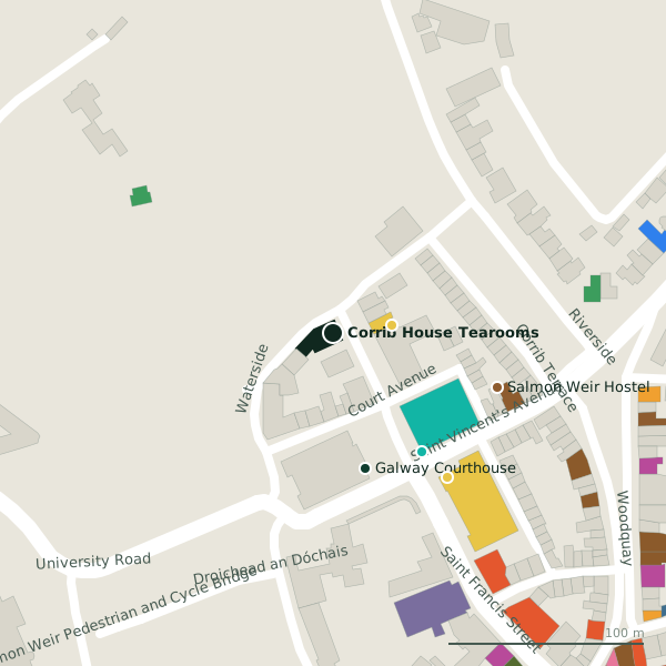
Plan of the surrounding 300 m
Getting to Corrib House Tearooms
- By car
- Park at Cathedral Car Park, 233 m away, paid, 130 spaces.
- By bus
- The nearest stop is Francis Street, served by Bus Éireann;City Direct, 153 m away.
- Directions from where you are
- Open the model above, tap the pin and choose “Directions here”; the route is drawn from your own position.
While you are there
34 places to eat and drink within 300 m: McGinn’s Hop House (144 m), Brazco (153 m), Hughes’ Bar (158 m) and Osteria Italiana Da Simone (188 m) and more.
27 shops within 300 m, including Woodquay Stores, thistles and AgeAction.
Waterside itself has 2 named places on the map.
Within a short walk
- 30 m
- Galway Courthouse71 mCourthouse
- Town Hall Theatre75 mTheatre
- Salmon Weir Hostel88 mHostels
- SALI Childcare94 mChildcare
- Woodquay Park117 mParks
- Fisheries Field121 mParks
- Salmon Weir Bridge132 mViewpoints
Also on Waterside
Other cafés in Galway
- Brazco153 mSaint Francis Street
- Tribe202 mSaint Francis Street
- Gourmet Tart Co.222 mSaint Francis Street
- Sip & Bowl230 mEyre Street
- Cafe Roscoe's234 mEglinton Street
- Renzo281 mEyre Street
- Focaccino289 mEyre Street
- Kettle Cafe299 mEyre Street
Questions people ask
Where is Corrib House Tearooms?
How do I contact Corrib House Tearooms?
Are there other cafés nearby?
Source record: OpenStreetMap node/1901946220, read on 2026-09-18. The street is the mapped address where there is one, otherwise the nearest named road. Distances are straight lines.