Salmon Weir Bridge
Salmon Weir Bridge is a viewpoint on Droichead an Dóchais in Galway, County Galway, 478 m west of Eyre Square. Cathedral, Galway Courthouse and Galway Cathedral are within 121 m.
- Kind
- Viewpoints
- Street
- Droichead an Dóchais
- From Eyre Square
- 478 m west
- Wheelchair
- Accessible
- Parking
- Cathedral Car Park, 112 m away
- Bus stop
- Galway Cathedral (Bus Éireann;City Direct), 75 m away
The map does not yet record a phone number, a website or opening hours for Salmon Weir Bridge. Anyone can add them on OpenStreetMap; this page picks the change up at the next refresh.
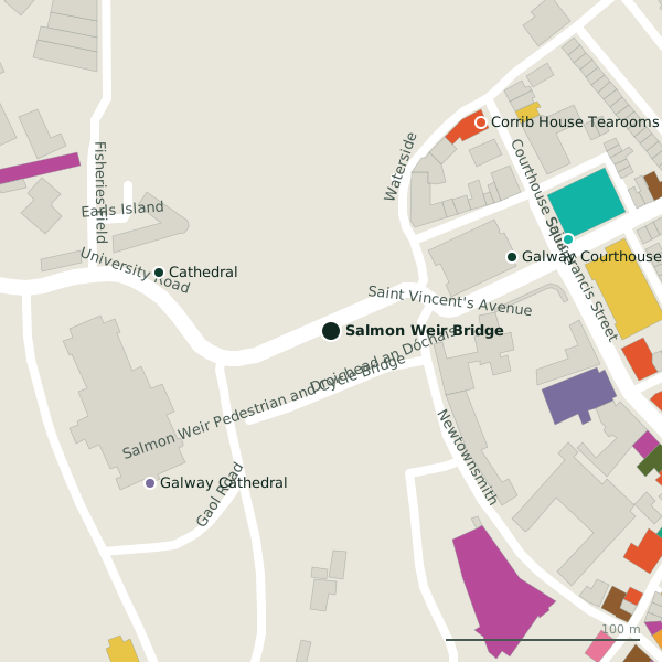
Getting to Salmon Weir Bridge
- By car
- Park at Cathedral Car Park, 112 m away, paid, 130 spaces.
- By bus
- The nearest stop is Galway Cathedral, served by Bus Éireann;City Direct, 75 m away.
- Directions from where you are
- Open the model above, tap the pin and choose “Directions here”; the route is drawn from your own position.
While you are there
37 places to eat and drink within 300 m: Corrib House Tearooms (132 m), Papa Rich (151 m), Brazco (160 m) and Osteria Italiana Da Simone (188 m) and more.
24 shops within 300 m, including COPE Galway, An Mheitheal Rothar and Chime.
Other sites within 3 km: Fisheries Field (167 m), Galway Gaol (169 m), Woodquay Park (224 m), College Park (299 m) and Millennium Children's Park (302 m).
Within a short walk
- Cathedral93 mBike hire
- Galway Courthouse100 mCourthouse
- Galway Cathedral121 mChurches
- Town Hall Theatre130 mTheatre
- 132 m
- Saint Francis "The Abbey"138 mChurches
- SALI Childcare139 mChildcare
- COPE Galway140 mCharity shops
Other viewpoints around Galway
- 4.9 km
Questions people ask
Where is Salmon Weir Bridge?
Are there other viewpoints nearby?
Source record: OpenStreetMap node/5890684185, read on 2026-09-18. The street is the mapped address where there is one, otherwise the nearest named road. Distances are straight lines.