Foodland
Foodland is a convenience store on Old Seamus Quirke Road in Galway, County Galway, 1.5 km west of Eyre Square. Vincents Curiosity Shop, Aroma Foods and An Post, Seamus Quirke Road are within 19 m.
- Street
- Old Seamus Quirke Road
- From Eyre Square
- 1.5 km west
- Wheelchair
- Accessible
- Parking
- Car Park 3, 289 m away
- Bus stop
- Davis Road (Bus Éireann), 90 m away
The map does not yet record a phone number, a website or opening hours for Foodland. Anyone can add them on OpenStreetMap; this page picks the change up at the next refresh.
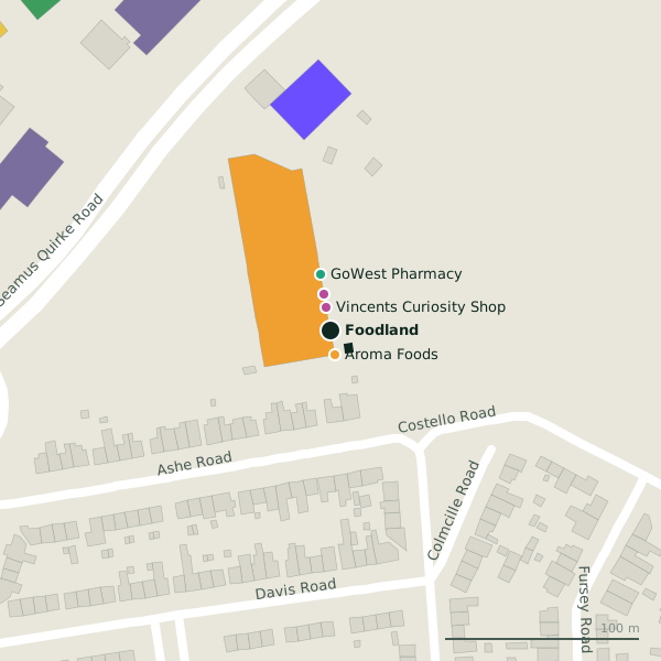
Plan of the surrounding 300 m
Getting to Foodland
- By car
- Park at Car Park 3, 289 m away, paid.
- By bus
- The nearest stop is Davis Road, served by Bus Éireann, 90 m away.
- Directions from where you are
- Open the model above, tap the pin and choose “Directions here”; the route is drawn from your own position.
While you are there
3 places to eat and drink within 300 m: Domino's (238 m), The Captain's Cabin (244 m) and McDonald's (298 m).
9 shops within 300 m, including Vincents Curiosity Shop, Aroma Foods and Mr. Price.
Old Seamus Quirke Road itself has 10 named places on the map.
Within a short walk
- Vincents Curiosity Shop12 mCharity shops
- Aroma Foods13 mConvenience stores
- An Post, Seamus Quirke Road19 mPost office
- Mr. Price19 mVariety stores
- GoWest Pharmacy30 mPharmacies
- Saint Joseph's Community Centre33 mCommunity centres
- Aldi85 mSupermarkets
- Bank of Ireland114 mCash machines
Also on Old Seamus Quirke Road
- AldiSupermarkets
- An Post, Seamus Quirke RoadPost office
- Aroma FoodsConvenience stores
- Domino'sTakeaways
- GoWest PharmacyPharmacies
- Mr. PriceVariety stores
- Select CartridgePrinter ink
- The Captain's CabinTakeaways
Everything on Old Seamus Quirke Road (10 places)
Other convenience stores in Galway
- Aroma Foods13 mOld Seamus Quirke Road
- Centra119 mSeamus Quirke Road
- Londis548 mNewcastle Road
- Tesco Express553 mUniversity Road
- Laurel Stores689 mLaurel Park
- Centra723 mUpper Newcastle Road
- Student's Union Shop792 mLower Newcastle Road
- Farraghers Nearbuy1.0 kmSea Road
Questions people ask
Where is Foodland?
Are there other convenience stores nearby?
Source record: OpenStreetMap way/954418406, read on 2026-09-18. The street is the mapped address where there is one, otherwise the nearest named road. Distances are straight lines.