Convenience stores · Laurel Park · Galway
Laurel Stores
Laurel Stores is a convenience store on Laurel Park in Galway, County Galway, 1.9 km north-west of Eyre Square. Petra, Páirc Tommy Keane and Laurel Park are within 236 m.
- Street
- Laurel Park
- From Eyre Square
- 1.9 km north-west
- Wheelchair
- Not accessible
- Parking
- Car Park 3, 616 m away
- Bus stop
- Stop (Bus Éireann), 75 m away
The map does not yet record a phone number, a website or opening hours for Laurel Stores. Anyone can add them on OpenStreetMap; this page picks the change up at the next refresh.
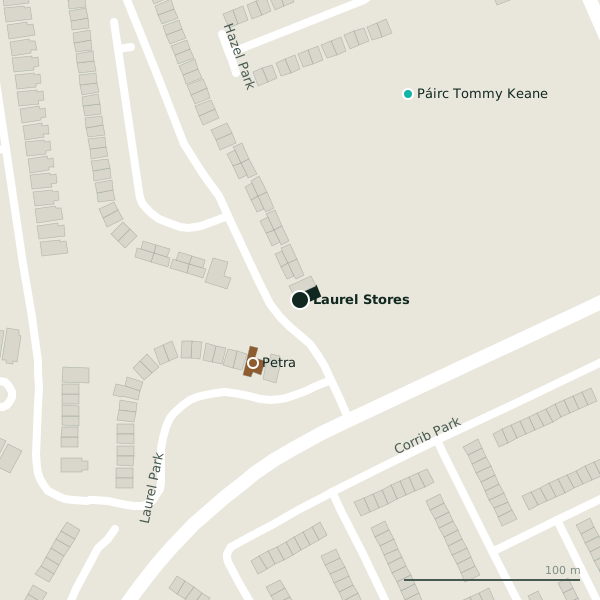
The building in black is this one; drag to turn the model.Open the whole town
Plan of the surrounding 300 m
Getting to Laurel Stores
- By car
- Park at Car Park 3, 616 m away, paid.
- By bus
- The nearest stop is an unnamed stop, served by Bus Éireann, 75 m away, with a shelter.
- Directions from where you are
- Open the model above, tap the pin and choose “Directions here”; the route is drawn from your own position.
While you are there
Laurel Park itself has 2 named places on the map.
Within a short walk
- Petra45 mGuest houses
- Páirc Tommy Keane132 mPitches
- Laurel Park236 mParks
Also on Laurel Park
- PetraGuest houses
Other convenience stores in Galway
- Centra572 mSeamus Quirke Road
- Centra688 mUpper Newcastle Road
- Foodland689 mOld Seamus Quirke Road
- Aroma Foods702 mOld Seamus Quirke Road
- Spar827 mUpper Newcastle Road
- Student's Union Shop964 mLower Newcastle Road
- Day-Today965 mCorrib Village
- Tesco Express977 mUniversity Road
Questions people ask
Where is Laurel Stores?
On Laurel Park in Galway, 1.9 km north-west of Eyre Square; the nearest car park is 616 m away.
Are there other convenience stores nearby?
81 other convenience stores in $Galway; the closest is Centra, 572 m away.
Source record: OpenStreetMap node/2148173604, read on 2026-09-18. The street is the mapped address where there is one, otherwise the nearest named road. Distances are straight lines.