Galway Gaol
Galway Gaol is a monument on Gaol Road in Galway, County Galway, 514 m west of Eyre Square. Gaol Road, Galway Library Services and Poor Clares Convent are within 85 m.
The map does not yet record a phone number, a website or opening hours for Galway Gaol. Anyone can add them on OpenStreetMap; this page picks the change up at the next refresh.
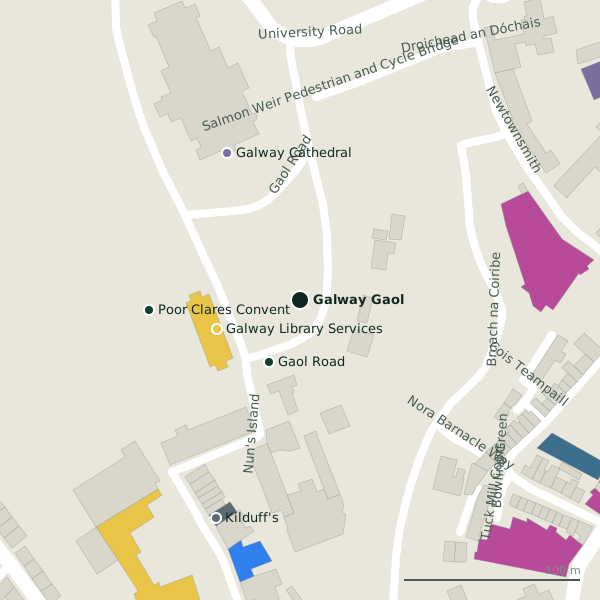
Getting to Galway Gaol
- By car
- Park at Cathedral on Gaol Road, 12 m away, paid, 162 spaces.
- By bus
- The nearest stop is an unnamed stop, 117 m away, with a shelter.
- Directions from where you are
- Open the model above, tap the pin and choose “Directions here”; the route is drawn from your own position.
While you are there
44 places to eat and drink within 300 m: Papa Rich (140 m), Abbeygate Cafe and Bistro (202 m), Pasta Factory (210 m) and Sally Long’s (210 m) and more.
25 shops within 300 m, including COPE Galway, Suzanne's Boutique and Anthony Ryans Homestore.
Gaol Road itself has 4 named places on the map, and 3 car parks along it.
Other sites within 3 km: Salmon Weir Bridge (169 m), Lynch Memorial Window (226 m), Millennium Children's Park (285 m), Legend of the Claddagh Ring (292 m) and Lynch's Castle (318 m).
Within a short walk
- Gaol Road39 mBike hire
- Galway Library Services50 mLibrary
- Poor Clares Convent85 mMonastery
- Galway Cathedral93 mChurches
- Kilduff's132 mGarages
- Papa Rich139 mRestaurants
- COPE Galway141 mCharity shops
- Samaritans159 mSocial services
Also on Gaol Road
- Galway CathedralChurches
- Galway Library ServicesLibrary
- Gaol RoadBike hire
Other monuments around Galway
- Lynch Memorial Window226 mMarket Street
- Lynch's Castle318 mAbbeygate Street Upper
- Martin Theatre338 mKirwan's Lane
- Richard Martin M.P. 1754-1834356 mQuay Street
- Pat Bracken 1951-2010360 mQuay Street
- Mechanics Institute366 mMiddle Street
- Blake's Castle403 mQuay Street
- Hall of the Red Earl406 mDruid Lane
Questions people ask
Where is Galway Gaol?
Are there other monuments nearby?
Source record: OpenStreetMap node/1865574475, read on 2026-09-18. The street is the mapped address where there is one, otherwise the nearest named road. Distances are straight lines.