HSE Audiology Service
HSE Audiology Service is an audiologist on Sea Road in Galway, County Galway, 1.1 km south-west of Eyre Square. John M. Ford & Son Solicitors, Galway West Physiotherapy and Galway City Medical Centre are within 67 m.
- Kind
- Audiologist
- Street
- 10 Sea Road
- From Eyre Square
- 1.1 km south-west
- Phone
- +353 91 582 111
- Website
- www2.hse.ie
- Run by
- Health Service Executive
- Parking
- Claddagh Church on Claddagh Quay, 454 m away
- Bus stop
- Fr Griffin Avenue (Bus Éireann), 98 m away
The map does not yet record opening hours for HSE Audiology Service. Anyone can add them on OpenStreetMap; this page picks the change up at the next refresh.
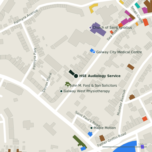
Plan of the surrounding 300 m
Getting to HSE Audiology Service
- By car
- Park at Claddagh Church on Claddagh Quay, 454 m away, paid.
- By bus
- The nearest stop is Fr Griffin Avenue, served by Bus Éireann, 98 m away.
- Directions from where you are
- Open the model above, tap the pin and choose “Directions here”; the route is drawn from your own position.
While you are there
20 places to eat and drink within 300 m: Kai (126 m), Woozza Pizza Takeaway (148 m), Woozza (152 m) and The Crane Bar (182 m) and more.
8 shops within 300 m, including Ernie's, The Laundrette and Farraghers Nearbuy.
Sea Road itself has 12 named places on the map.
Within a short walk
- John M. Ford & Son Solicitors28 mSolicitors
- Galway West Physiotherapy47 mPhysiotherapist
- Galway City Medical Centre67 mDoctors
- Church of Saint Ignatius113 mChurches
- Maple Motion121 mPhysiotherapist
- Linderhof B&B124 mGuest houses
- Kai126 mRestaurants
- Galway Dentists133 mDentists
Also on Sea Road
- Coláiste IognáidSchools
- Ernie'sGreengrocers
- Farraghers NearbuyConvenience stores
- Galway City Medical CentreDoctors
- James Heffernan Shoe RepairsShoe repair
- John M. Ford & Son SolicitorsSolicitors
- KaiRestaurants
- The Crane BarPubs
Everything on Sea Road (12 places)
Questions people ask
Where is HSE Audiology Service?
How do I contact HSE Audiology Service?
Source record: OpenStreetMap node/11012508143, read on 2026-09-18. The street is the mapped address where there is one, otherwise the nearest named road. Distances are straight lines.