HSE Enhanced Community Care Network
HSE Enhanced Community Care Network is a government office on Galway Business Park in Galway, County Galway, 2.5 km north-west of Eyre Square. Ceroflo, Palliare and Janisys are within 28 m.
- Street
- Galway Business Park
- From Eyre Square
- 2.5 km north-west
- Website
- hse.ie
- Run by
- Health Service Executive
- Parking
- Unit 6 Visitor Car Park on Galway Business Park, 84 m away
- Bus stop
- Stop (University of Galway), 304 m away
The map does not yet record a phone number or opening hours for HSE Enhanced Community Care Network. Anyone can add them on OpenStreetMap; this page picks the change up at the next refresh.
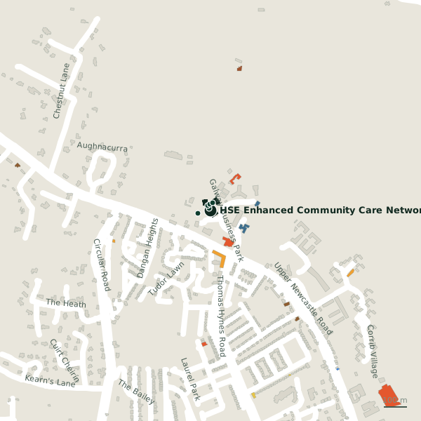
Plan of the surrounding 300 m
Getting to HSE Enhanced Community Care Network
- By car
- Park at Unit 6 Visitor Car Park on Galway Business Park, 84 m away, free.
- By bus
- The nearest stop is an unnamed stop, served by University of Galway, 304 m away, with a shelter.
- Directions from where you are
- Open the model above, tap the pin and choose “Directions here”; the route is drawn from your own position.
While you are there
2 places to eat and drink within 300 m: DERI Café (168 m) and Dangan House Tearooms (181 m).
2 shops within 300 m, including Spar and Dangan House Garden Centre.
Galway Business Park itself has 17 named places on the map, and 2 car parks along it.
Within a short walk
Also on Galway Business Park
- AerogenCompanies
- AerogenCompanies
- CerofloCompanies
- DERI CaféCafés
- HES Enviromential Health ServicesGovernment offices
- JanisysCompanies
- Marvao MedicalCompanies
- ONK TherapeuticsIT companies
Everything on Galway Business Park (17 places)
Other government offices in Galway
- HES Enviromential Health Services205 mGalway Business Park
- Central Applications Office2.4 kmEglinton Street
- Galway County Council2.4 kmProspect Hill
- Intreo2.7 kmFairgreen Road
- Citizens Information2.7 kmSaint Augustine Street
- Galway City Council2.7 kmCollege Road
- Revenue Commissioners2.8 kmFairgreen Road
- Irish Water3.5 kmMonivea Road
Questions people ask
Where is HSE Enhanced Community Care Network?
Are there other government offices nearby?
Source record: OpenStreetMap node/11945629624, read on 2026-09-18. The street is the mapped address where there is one, otherwise the nearest named road. Distances are straight lines.