Irish Water
Irish Water is a government office on Monivea Road in Galway, County Galway, 2.2 km north-east of Eyre Square. Arup Consulting, The Rhatigan Group and Arm Technologies are within 27 m.
- Street
- Monivea Road
- From Eyre Square
- 2.2 km north-east
- Bus stop
- Monivea Road (Bus Éireann), 37 m away
The map does not yet record a phone number, a website or opening hours for Irish Water. Anyone can add them on OpenStreetMap; this page picks the change up at the next refresh.
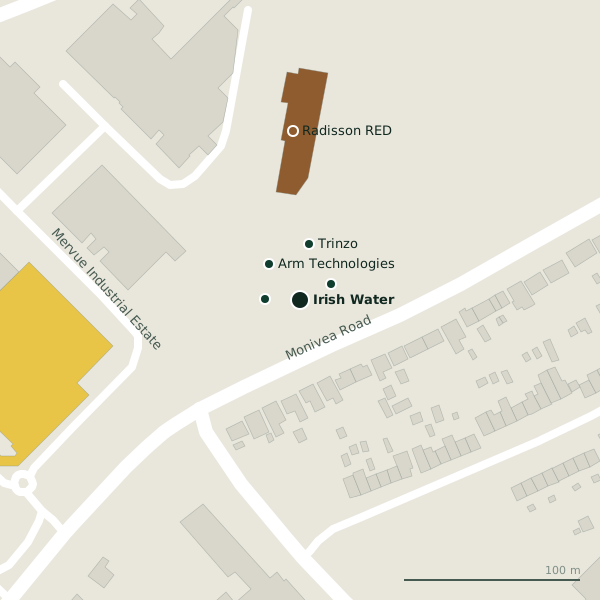
Getting to Irish Water
- By bus
- The nearest stop is Monivea Road, served by Bus Éireann, 37 m away.
- Directions from where you are
- Open the model above, tap the pin and choose “Directions here”; the route is drawn from your own position.
While you are there
1 place to eat or drink within 300 m: The Trappers Inn (257 m).
2 shops within 300 m, including Cunniffe Electrical and Cases Wine Warehouse.
Monivea Road itself has 19 named places on the map.
Within a short walk
- Arup Consulting20 mCompanies
- The Rhatigan Group20 mCompanies
- Arm Technologies27 mCompanies
- Trinzo32 mCompanies
- Radisson RED96 mHotels
- GRETB Training Centre182 mColleges
- Galway Primary Care227 mDoctors
Also on Monivea Road
- Arm TechnologiesCompanies
- Arup ConsultingCompanies
- Bee GreenDry cleaners
- CitroënCar dealers
- Clayton HotelHotels
- Cregal Art SuppliesCraft shops
- DaciaCar dealers
Everything on Monivea Road (19 places)
Other government offices in Galway
- National Standards Authority of Ireland971 mBallybrit Business Park
- National Roads Design Office1.3 kmBallybrit Business Park
- Galway City Council1.8 kmCollege Road
- Intreo2.0 kmFairgreen Road
- Revenue Commissioners2.0 kmFairgreen Road
- Galway County Council2.1 kmProspect Hill
- Central Applications Office2.4 kmEglinton Street
- Citizens Information2.6 kmSaint Augustine Street
Questions people ask
Where is Irish Water?
Are there other government offices nearby?
Source record: OpenStreetMap node/13254995389, read on 2026-09-18. The street is the mapped address where there is one, otherwise the nearest named road. Distances are straight lines.