Monivea Road
Monivea Road is the R339, a service road in Galway, 3.4 km north-east of Eyre Square. It runs 3.1 km from Connolly Avenue, about 39 minutes on foot end to end. It has 19 named places on the map: 5 car dealers, 4 companies, 2 hotels and dry cleaner and more.
- Type
- Service road (R339)
- Length
- 3.1 km of mapped road
- From Eyre Square
- 3.4 km north-east
- Joins
- An Luasán, Ballybane Road, Ballybrit Court, Ballybrit Heights, Ballybrit Industrial Estate Upper, Bóthar Na dTreabh, Castle Park, Castlepark Road, Clarke Avenue, Cluain Árd, Connolly Avenue, Cúirt na Rasaí, Dun Léinn, Gort Léinn, Gort Na gCapall, Lios Caisil, McDonagh Avenue, Monivea Park, Na Creaga, Old Monivea Road, Oldenway Business Park, Racecourse Lawn, Radharc Na Gréine, Rocklands Avenue, Santa Maris, Teach Briota, The Meadows, The Paddocks, Tír Na gCapall, Wellpark Road
- Runs
- from Connolly Avenue
- Bus stops
- Monivea Road; Monivea Park; Ballybrit Ind Est; Ballybrit Heights; An Luasán; Monivea Road; Clayton Hotel; The Paddocks; Ballybrit Heights; Ballybrit Ind Est; Monivea Park; Clarke Avenue
- Nearest parking
- Clareview Park on Clareview Park, 790 m away
- Density
- 19 named places over 3.1 km, 0.6 per 100 m
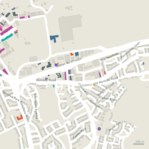
The street is drawn in black; buildings are coloured by what is in them. Drag to turn the model, tap a pin for the place.
Plan of the street
A walk along Monivea Road
Walking its length 5 car dealers, 4 companies, 2 hotels, a dry cleaner, a craft shop and a bar and more share the 3.1 km. 6 of the 19 places on the street have opening hours on record. Buses stop on the street itself at 12 stops.
What is on Monivea Road
5 car dealers, 4 companies, 2 hotels, 1 dry cleaners and 1 craft shops and more, each with its own page.
Restaurants · 1
- KFCTakeaways
Pubs · 1
Shops · 2
- Bee GreenDry cleaners
- Cregal Art Supplies+353 91 751 864Craft shops
Offices and agents · 2
- Irish WaterGovernment offices
- Kirby GroupEngineers
Petrol · 5
Gyms and sport · 1
- The Warehouse Gym+353 83 013 1925Gyms · hours on record
Hotels · 2
- Clayton HotelHotels
- Radisson RED+353 91 379 100Hotels
Other places · 5
- Arm TechnologiesCompanies
- Arup ConsultingCompanies
- Galway Express CouriersLogistics
- The Rhatigan GroupCompanies
- TrinzoCompanies
Streets it joins
- An Luasánresidential street
- Ballybane Roadregional road · 6 places
- Ballybrit Courtresidential street · 1 place
- Ballybrit Heightsresidential street
- Ballybrit Industrial Estate Upperminor road · 8 places
- Bóthar Na dTreabhnational road · 9 places
- Castle Parkresidential street · 1 place
- Castlepark Roadlink road · 1 place
- Clarke Avenueresidential street
- Cluain Árdresidential street
- Connolly Avenuelink road · 1 place
- Cúirt na Rasaíresidential street
- Dun Léinnresidential street
- Gort Léinnresidential street
- Gort Na gCapallresidential street
- Lios Caisilresidential street
- McDonagh Avenueresidential street
- Monivea Parkresidential street
- Na Creagaresidential street
- Old Monivea Roadlink road · 1 place
- Oldenway Business Parkservice road · 24 places
- Racecourse Lawnresidential street
- Radharc Na Gréineresidential street
- Rocklands Avenueresidential street
- Santa Marisresidential street
- Teach Briotaresidential street
- The Meadowsresidential street
- The Paddocksresidential street
- Tír Na gCapallresidential street
- Wellpark Roadresidential street · 1 place
Questions people ask
Where is Monivea Road?
How long is Monivea Road?
What is on Monivea Road?
Is there a bus stop on Monivea Road?
Where can I park near Monivea Road?
Geometry, names and places from OpenStreetMap, read on 2026-09-18. Length is the sum of the mapped segments carrying this name; distances are straight lines from the street's midpoint.