Enclosure Bar & Bistro
Enclosure Bar & Bistro is a bar on Monivea Road in Galway, County Galway, 4.4 km north-east of Eyre Square. The kitchen is listed as bistro. Clayton Hotel, Cafe Sol and Dunnes Stores are within 121 m.
- Kind
- Bars
- Street
- Monivea Road
- From Eyre Square
- 4.4 km north-east
- Website
- claytonhotelgalway.ie
- Bus stop
- Monivea Road (Bus Éireann), 35 m away
The map does not yet record a phone number or opening hours for Enclosure Bar & Bistro. Anyone can add them on OpenStreetMap; this page picks the change up at the next refresh.
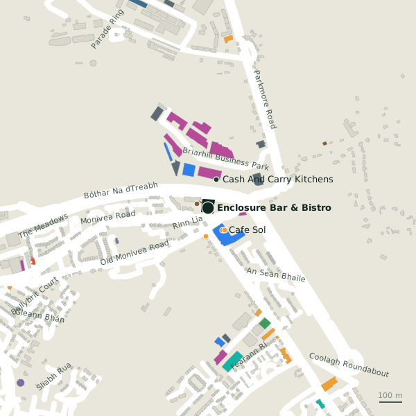
Plan of the surrounding 300 m
Getting to Enclosure Bar & Bistro
- By bus
- The nearest stop is Monivea Road, served by Bus Éireann, 35 m away, with a shelter.
- Directions from where you are
- Open the model above, tap the pin and choose “Directions here”; the route is drawn from your own position.
While you are there
5 places to eat and drink within 300 m: Cafe Sol (116 m), KFC (155 m), Grind Coffee and Food Hub (176 m) and Roots (233 m) and more.
14 shops within 300 m, including Dunnes Stores, Coynes Foodmarket and J&D Furniture.
Monivea Road itself has 19 named places on the map.
Within a short walk
- Clayton Hotel51 mHotels
- Cafe Sol116 mCafés
- Dunnes Stores121 mSupermarkets
- Coynes Foodmarket124 mConvenience stores
- Cash And Carry Kitchens128 mKitchen
- Cutting Edge Tiles128 mFlooring
- Optima Strength128 mCompanies
- Secure All Security Group128 mSecurity
Also on Monivea Road
- Arm TechnologiesCompanies
- Arup ConsultingCompanies
- Bee GreenDry cleaners
- CitroënCar dealers
- Clayton HotelHotels
- Cregal Art SuppliesCraft shops
- DaciaCar dealers
- Galway Express CouriersLogistics
Everything on Monivea Road (19 places)
Other bars in Galway
- Point Bar3.8 kmSandyroad
- 4.1 km
- HYDE Bar4.3 kmForster Street
- The Boss Doyle’s Bar4.3 kmForster Street
- Mary Mullen’s4.4 kmProspect Hill
- The Oyster Bar4.4 kmEyre Square
- Buddha Bar4.7 kmMary Street
- Coyotes4.8 kmShop Street
Questions people ask
Where is Enclosure Bar & Bistro?
Are there other bars nearby?
Source record: OpenStreetMap node/11393812615, read on 2026-09-18. The street is the mapped address where there is one, otherwise the nearest named road. Distances are straight lines.