John Keogh’s
John Keogh’s is a pub on Dominick Street Upper in Galway, County Galway, 800 m south-west of Eyre Square. China Town, Oscars and Giovanni's are within 14 m.
- Kind
- Pubs
- From Eyre Square
- 800 m south-west
- Phone
- +353 91 449 431
- Website
- johnkeoghs.ie
- Parking
- Claddagh Church on Claddagh Quay, 265 m away
- Bus stop
- Fr Griffin Road (Bus Éireann), 169 m away
The map does not yet record opening hours for John Keogh’s. Anyone can add them on OpenStreetMap; this page picks the change up at the next refresh.
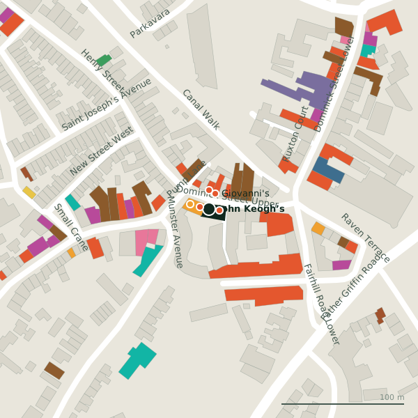
Plan of the surrounding 300 m
Getting to John Keogh’s
- By car
- Park at Claddagh Church on Claddagh Quay, 265 m away, paid.
- By bus
- The nearest stop is Fr Griffin Road, served by Bus Éireann, 169 m away, with a shelter.
- Directions from where you are
- Open the model above, tap the pin and choose “Directions here”; the route is drawn from your own position.
While you are there
47 places to eat and drink within 300 m: China Town (8 m), Oscars (9 m), Giovanni's (14 m) and Habib & Abu (15 m) and more.
18 shops within 300 m, including No. 26, Candy Vintage Clothing and Centra.
Dominick Street Upper itself has 16 named places on the map.
Within a short walk
- China Town8 mRestaurants
- Oscars9 mRestaurants
- Giovanni's14 mTakeaways
- Habib & Abu15 mRestaurants
- No. 2616 mConvenience stores
- IT Fix17 mElectronics repair
- PLÁMÁS19 mCafés
- Laura Jane22 mErotic
Also on Dominick Street Upper
- China TownRestaurants
- Deli la TascaRestaurants
- Giovanni'sTakeaways
- Habib & AbuRestaurants
- IT FixElectronics repair
- Kings CasinoCasino
- Laura JaneErotic
- Monroe’sPubs
Everything on Dominick Street Upper (16 places)
Other pubs in Galway
- Taylor’s23 mDominick Street Upper
- Bierhaus32 mHenry Street
- Róisín Dubh32 mDominick Street Upper
- The Blue Note50 mWilliam Street West
- Monroe’s65 mDominick Street Upper
- The Universal77 mWilliam Street West
- Massimo84 mWilliam Street West
- Carroll’s Bar110 mDominick Street Lower
Questions people ask
Where is John Keogh’s?
How do I contact John Keogh’s?
Are there other pubs nearby?
Source record: OpenStreetMap node/5795606853, read on 2026-09-18. The street is the mapped address where there is one, otherwise the nearest named road. Distances are straight lines.