Taylor’s
Taylor’s is a pub on Dominick Street Upper in Galway, County Galway, 777 m south-west of Eyre Square. PLÁMÁS, Róisín Dubh and IT Fix are within 13 m.
- Kind
- Pubs
- Street
- 7 Dominick Street Upper
- From Eyre Square
- 777 m south-west
- Parking
- Claddagh Church on Claddagh Quay, 256 m away
- Bus stop
- Fr Griffin Road (Bus Éireann), 177 m away
The map does not yet record a phone number, a website or opening hours for Taylor’s. Anyone can add them on OpenStreetMap; this page picks the change up at the next refresh.
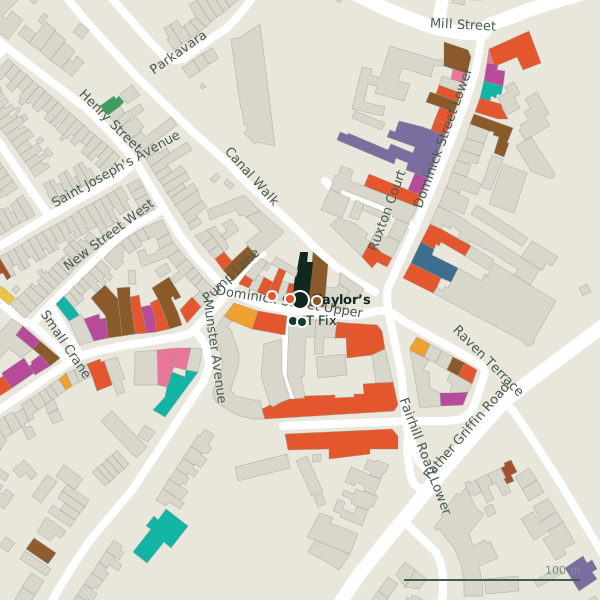
Plan of the surrounding 300 m
Getting to Taylor’s
- By car
- Park at Claddagh Church on Claddagh Quay, 256 m away, paid.
- By bus
- The nearest stop is Fr Griffin Road, served by Bus Éireann, 177 m away, with a shelter.
- Directions from where you are
- Open the model above, tap the pin and choose “Directions here”; the route is drawn from your own position.
While you are there
56 places to eat and drink within 300 m: PLÁMÁS (6 m), Róisín Dubh (9 m), Giovanni's (16 m) and Oscars (17 m) and more.
21 shops within 300 m, including No. 26, Centra and Candy Vintage Clothing.
Dominick Street Upper itself has 16 named places on the map.
Within a short walk
- PLÁMÁS6 mCafés
- Róisín Dubh9 mPubs
- IT Fix13 mElectronics repair
- Laura Jane13 mErotic
- Giovanni's16 mTakeaways
- Oscars17 mRestaurants
- Kings Casino20 mCasino
- Habib & Abu21 mRestaurants
Also on Dominick Street Upper
- China TownRestaurants
- Deli la TascaRestaurants
- Giovanni'sTakeaways
- Habib & AbuRestaurants
- IT FixElectronics repair
- John Keogh’sPubs
- Kings CasinoCasino
- Laura JaneErotic
Everything on Dominick Street Upper (16 places)
Other pubs in Galway
- Róisín Dubh9 mDominick Street Upper
- John Keogh’s23 mDominick Street Upper
- Bierhaus42 mHenry Street
- Monroe’s47 mDominick Street Upper
- The Blue Note72 mWilliam Street West
- Carroll’s Bar87 mDominick Street Lower
- The Salt House96 mRaven Terrace
- The Universal99 mWilliam Street West
Questions people ask
Where is Taylor’s?
Are there other pubs nearby?
Source record: OpenStreetMap node/9925226609, read on 2026-09-18. The street is the mapped address where there is one, otherwise the nearest named road. Distances are straight lines.