Leisureland
Leisureland is a sports centre on Rockbarton Road in Galway, County Galway, 2.8 km south-west of Eyre Square. Leisureland Theatre, Salthill Bandstand and Salthill Garda Station are within 143 m.
- Kind
- Sports centres
- Street
- Rockbarton Road
- From Eyre Square
- 2.8 km south-west
- Website
- leisureland.ie
- Wheelchair
- Accessible
- Parking
- National Aquarium Car Park on Seapoint Promenade, 570 m away
- Bus stop
- Dalysfort Road (Bus Éireann), 176 m away
The map does not yet record a phone number or opening hours for Leisureland. Anyone can add them on OpenStreetMap; this page picks the change up at the next refresh.
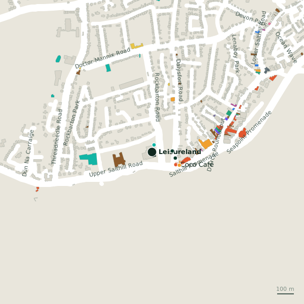
Plan of the surrounding 300 m
Getting to Leisureland
- By car
- Park at National Aquarium Car Park on Seapoint Promenade, 570 m away, free, 27 spaces.
- By bus
- The nearest stop is Dalysfort Road, served by Bus Éireann, 176 m away.
- Directions from where you are
- Open the model above, tap the pin and choose “Directions here”; the route is drawn from your own position.
While you are there
7 places to eat and drink within 300 m: Coco Café (161 m), The Creamery (200 m), Atlantic Bar (204 m) and Magnetti’s (221 m) and more.
2 shops within 300 m, including Spar and Quinn's Bon-Bon.
Rockbarton Road itself has 2 named places on the map.
Within a short walk
- Leisureland Theatre44 mTheatre
- Salthill Bandstand121 mBandstand
- Salthill Garda Station143 mGarda station
- Coco Café161 mCafés
- Spar180 mConvenience stores
- Galway Bay Hotel184 mHotels
- Euronet189 mCash machines
- Colm’s Amusement Centre196 mCasino
Also on Rockbarton Road
- Leisureland TheatreTheatre
Other sports centres in Galway
- The Prarie598 mDoctor Mannix Road
- Galway Lawn Tennis Club685 mThreadneedle Road
- Pure Skill1.8 kmWestern Distributor Road
- Rusheen Bay Windsurfing School2.5 kmBarna Road
- Galway Ocean Sports Club2.8 kmGalway Harbour Enterprise Park
- 2.9 km
- 2.9 km
- Galway Hibernians AFC3.5 kmSean Mulvoy Road
Questions people ask
Where is Leisureland?
Are there other sports centres nearby?
Source record: OpenStreetMap way/1035229124, read on 2026-09-18. The street is the mapped address where there is one, otherwise the nearest named road. Distances are straight lines.