Galway Hibernians AFC
Galway Hibernians AFC is a sports centre on Sean Mulvoy Road in Galway, County Galway, 872 m north of Eyre Square. Wash Me, Nando's and Bodkin are within 98 m.
- Kind
- Sports centres
- Street
- Sean Mulvoy Road
- From Eyre Square
- 872 m north
- Parking
- Dyke Road Car Park on Dyke Road, 561 m away
- Bus stop
- Stop (Bus Éireann), 162 m away
The map does not yet record a phone number, a website or opening hours for Galway Hibernians AFC. Anyone can add them on OpenStreetMap; this page picks the change up at the next refresh.
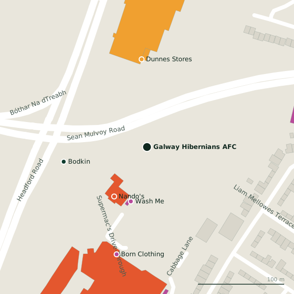
Getting to Galway Hibernians AFC
- By car
- Park at Dyke Road Car Park on Dyke Road, 561 m away, paid.
- By bus
- The nearest stop is an unnamed stop, served by Bus Éireann, 162 m away, with a shelter.
- Directions from where you are
- Open the model above, tap the pin and choose “Directions here”; the route is drawn from your own position.
While you are there
7 places to eat and drink within 300 m: Nando's (68 m), Supermac's (130 m), Álainn (170 m) and Franklins Restaurant (179 m) and more.
30 shops within 300 m, including Wash Me, Dunnes Stores and Born Clothing.
Sean Mulvoy Road itself has 16 named places on the map.
Within a short walk
- Wash Me65 mLaundries
- Nando's68 mRestaurants
- Bodkin98 mBike hire
- Dunnes Stores102 mSupermarkets
- Born Clothing129 mClothes shops
- Supermac's130 mTakeaways
- Bohermore Community Centre146 mCommunity centres
- CeX154 mElectronics
Also on Sean Mulvoy Road
- Ability WestNgo
- Bank of IrelandCash machines
- Better BeddingFurniture
- Carepoint Medical CentreClinics
- Convenant Christian FellowshipReligion
- FBD InsuranceInsurance
- FórsaUnion
- Galway Dental GroupDentists
Everything on Sean Mulvoy Road (16 places)
Other sports centres in Galway
- 402 m
- 717 m
- 1.1 km
- 1.6 km
- Galway Ocean Sports Club1.6 kmGalway Harbour Enterprise Park
- Galwegians RFC2.0 kmGlenina Heights
- Kingfisher Gym2.2 kmRenmore Avenue
- 2.3 km
Questions people ask
Where is Galway Hibernians AFC?
Are there other sports centres nearby?
Source record: OpenStreetMap way/205231994, read on 2026-09-18. The street is the mapped address where there is one, otherwise the nearest named road. Distances are straight lines.