Sports centres · Galway
Galway Kettle Bells
Galway Kettle Bells is a sports centre in the town in Galway, County Galway, 1.0 km north-east of Eyre Square. Flair Hair & Beauty Supplies, PPC and Carepoint Medical Centre are within 37 m.
- Kind
- Sports centres
- From Eyre Square
- 1.0 km north-east
- Parking
- Dyke Road Car Park on Dyke Road, 860 m away
- Bus stop
- Stop, 68 m away
The map does not yet record a phone number, a website or opening hours for Galway Kettle Bells. Anyone can add them on OpenStreetMap; this page picks the change up at the next refresh.
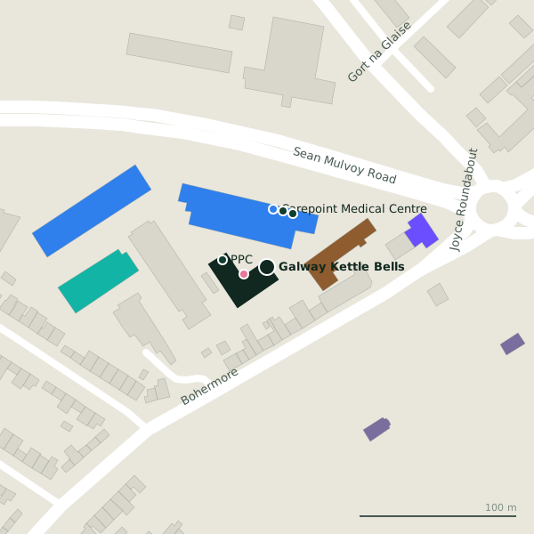
The building in black is this one; drag to turn the model.Open the whole town
Plan of the surrounding 300 m
Getting to Galway Kettle Bells
- By car
- Park at Dyke Road Car Park on Dyke Road, 860 m away, paid.
- By bus
- The nearest stop is an unnamed stop, 68 m away, with a shelter.
- Directions from where you are
- Open the model above, tap the pin and choose “Directions here”; the route is drawn from your own position.
While you are there
1 place to eat or drink within 300 m: The Clan Bar (293 m).
9 shops within 300 m, including Sliding Wardrobes, Better Bedding and Galway Simon Community Furniture & Fashion Shop.
Within a short walk
- 16 m
- PPC29 mNutrition supplements
- Carepoint Medical Centre37 mClinics
- Convenant Christian Fellowship37 mReligion
- Ability West38 mNgo
- Sliding Wardrobes39 mFurniture
- FBD Insurance40 mInsurance
- Passax Computers45 mComputer
Other sports centres in Galway
- Galway Hibernians AFC402 mSean Mulvoy Road
- 1.1 km
- 1.2 km
- 1.5 km
- Galway Ocean Sports Club1.6 kmGalway Harbour Enterprise Park
- Galwegians RFC1.6 kmGlenina Heights
- Kingfisher Gym1.8 kmRenmore Avenue
- 1.9 km
Questions people ask
Where is Galway Kettle Bells?
In Galway, County Galway, 1.0 km north-east of Eyre Square; the nearest car park is 860 m away.
Are there other sports centres nearby?
24 other sports centres in $Galway; the closest is Galway Hibernians AFC, 402 m away.
Source record: OpenStreetMap node/2102298913, read on 2026-09-18. The street is the mapped address where there is one, otherwise the nearest named road. Distances are straight lines.