Ability West
Ability West is a ngo on Sean Mulvoy Road in Galway, County Galway, 1.1 km north-east of Eyre Square. Convenant Christian Fellowship, FBD Insurance and Carepoint Medical Centre are within 13 m.
- Kind
- Ngo
- Street
- 2 Sean Mulvoy Road
- From Eyre Square
- 1.1 km north-east
- Website
- abilitywest.ie
- Wheelchair
- Accessible
- Parking
- Dyke Road Car Park on Dyke Road, 892 m away
- Bus stop
- Stop, 40 m away
The map does not yet record a phone number or opening hours for Ability West. Anyone can add them on OpenStreetMap; this page picks the change up at the next refresh.
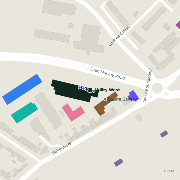
Plan of the surrounding 300 m
Getting to Ability West
- By car
- Park at Dyke Road Car Park on Dyke Road, 892 m away, paid.
- By bus
- The nearest stop is an unnamed stop, 40 m away, with a shelter.
- Directions from where you are
- Open the model above, tap the pin and choose “Directions here”; the route is drawn from your own position.
While you are there
9 shops within 300 m, including Sliding Wardrobes, Better Bedding and Galway Simon Community Furniture & Fashion Shop.
Sean Mulvoy Road itself has 16 named places on the map.
Within a short walk
- Convenant Christian Fellowship6 mReligion
- FBD Insurance7 mInsurance
- Carepoint Medical Centre13 mClinics
- Sliding Wardrobes20 mFurniture
- Swuite Galway34 mHotels
- Passax Computers35 mComputer
- Galway Kettle Bells38 mSports centres
- Better Bedding45 mFurniture
Also on Sean Mulvoy Road
- Bank of IrelandCash machines
- Better BeddingFurniture
- Carepoint Medical CentreClinics
- Convenant Christian FellowshipReligion
- FBD InsuranceInsurance
- FórsaUnion
- Galway Dental GroupDentists
- Galway Hibernians AFCSports centres
Everything on Sean Mulvoy Road (16 places)
Other ngo in Galway
- ISPCC Galway782 mHeadford Road
- Croí West Of Ireland Cardiac Foundation1.9 kmMoyola Lane
Questions people ask
Where is Ability West?
Are there other ngo nearby?
Source record: OpenStreetMap node/2102298916, read on 2026-09-18. The street is the mapped address where there is one, otherwise the nearest named road. Distances are straight lines.