Liberty IT
Liberty IT is a company on Bóthar na Long in Galway, County Galway, 326 m south of Eyre Square. Signify Health, Genesys and Diligent are within 36 m.
- Kind
- Companies
- Street
- Bóthar na Long
- From Eyre Square
- 326 m south
- Website
- liberty-it.ie
- Wheelchair
- Not accessible
- Parking
- Hynes Yard Car Park on Dock Road, 99 m away
- Bus stop
- Merchants Road (Bus Éireann), 183 m away
The map does not yet record a phone number or opening hours for Liberty IT. Anyone can add them on OpenStreetMap; this page picks the change up at the next refresh.
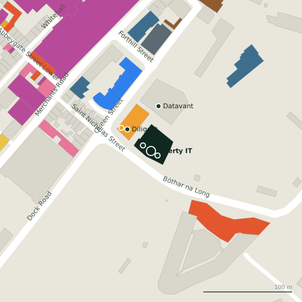
Plan of the surrounding 300 m
Getting to Liberty IT
- By car
- Park at Hynes Yard Car Park on Dock Road, 99 m away, paid.
- By bus
- The nearest stop is Merchants Road, served by Bus Éireann, 183 m away.
- Directions from where you are
- Open the model above, tap the pin and choose “Directions here”; the route is drawn from your own position.
While you are there
36 places to eat and drink within 300 m: Dillisk on the Docks (132 m), Aryan Pizzeria (154 m), Pascal Coffee House (172 m) and Jump Juice (178 m) and more.
75 shops within 300 m, including Costcutter, Mobile Street and Louis Copeland and Sons.
Bóthar na Long itself has 7 named places on the map, and 2 car parks along it.
Within a short walk
- Signify Health9 mCompanies
- Genesys11 mCompanies
- Diligent36 mCompanies
- Costcutter42 mConvenience stores
- Datavant51 mCompanies
- Lavelle's69 mPharmacies
- Gate Dental Clinic76 mDentists
- TechStar81 mElectronics repair
Also on Bóthar na Long
- CostcutterConvenience stores
- DiligentCompanies
- Dillisk on the DocksRestaurants
- GenesysCompanies
- Harbour HotelHotels
- Signify HealthCompanies
Other companies in Galway
- Signify Health9 mBóthar na Long
- Genesys11 mBóthar na Long
- Diligent36 mBóthar na Long
- Datavant51 mQueen Street
- MetLife208 mSaint Augustine Street
- Romero Games227 mAbbeygate Street Lower
- 299 m
- Citylink367 mForster Street
Questions people ask
Where is Liberty IT?
Are there other companies nearby?
Source record: OpenStreetMap node/13115041192, read on 2026-09-18. The street is the mapped address where there is one, otherwise the nearest named road. Distances are straight lines.