Paraffin
Paraffin is a clothes shop on Castle Street in Galway, County Galway, 172 m south-west of Eyre Square. Thérapie Clinic, Intersport Elverys and Søstrene Grene are within 22 m.
- Kind
- Clothes shops
- Street
- 1/2 Castle Street
- From Eyre Square
- 172 m south-west
- Wheelchair
- Accessible
- Parking
- Eyre Square Centre Car Park on Whitehall, 80 m away
- Bus stop
- Stop, 149 m away
The map does not yet record a phone number, a website or opening hours for Paraffin. Anyone can add them on OpenStreetMap; this page picks the change up at the next refresh.
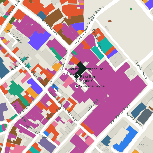
Plan of the surrounding 300 m
Getting to Paraffin
- By car
- Park at Eyre Square Centre Car Park on Whitehall, 80 m away, paid, 450 spaces.
- By bus
- The nearest stop is an unnamed stop, 149 m away, with a shelter.
- Directions from where you are
- Open the model above, tap the pin and choose “Directions here”; the route is drawn from your own position.
While you are there
133 places to eat and drink within 300 m: Krispy Kreme (37 m), Butlers Chocolate Café (53 m), Fixx (60 m) and Food for Thought (65 m) and more.
149 shops within 300 m, including Intersport Elverys, Fields and Mountain Warehouse.
Castle Street itself has 6 named places on the map, and 1 car park along it.
Within a short walk
- Thérapie Clinic12 mBeauty
- Intersport Elverys18 mSports shops
- Søstrene Grene22 mInterior decoration
- Fields28 mJewellers
- Mountain Warehouse28 mOutdoor shops
- Corbett Court29 mShopping centres
- Eir31 mPhone shops
- A. Hartmann & Son34 mJewellers
Also on Castle Street
- Corbett CourtShopping centres
- Dunnes StoresSupermarkets
- Penrice's TowerTowers
- SkechersShoe shops
- Søstrene GreneInterior decoration
Other clothes shops in Galway
- Tribes Sweater Shop35 mWilliam Street
- 47 m
- NAME IT56 mBallalley Lane
- Elegant Undies62 mBallalley Lane
- The Sweater Shop67 mArch Mews
- Vero Moda67 mBallalley Lane
- Swamp74 mBallalley Lane
- Lally Menswear84 mAbbeygate Street Upper
Questions people ask
Where is Paraffin?
Are there other clothes shops nearby?
Source record: OpenStreetMap node/9010204376, read on 2026-09-18. The street is the mapped address where there is one, otherwise the nearest named road. Distances are straight lines.