Jack & Jones
Jack & Jones is a clothes shop in the town in Galway, County Galway, 131 m south-west of Eyre Square. The Edge, Penrice's Tower and Art & Hobby are within 17 m.
- Kind
- Clothes shops
- From Eyre Square
- 131 m south-west
- Wheelchair
- Accessible
- Parking
- Eyre Square Centre Car Park on Whitehall, 76 m away
- Bus stop
- Eyre Square (Bus Éireann), 107 m away
The map does not yet record a phone number or a website for Jack & Jones. Anyone can add them on OpenStreetMap; this page picks the change up at the next refresh.
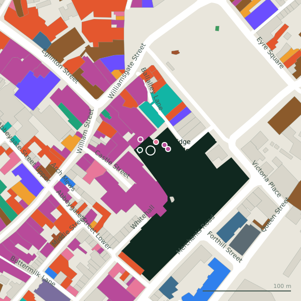
Plan of the surrounding 300 m
Getting to Jack & Jones
- By car
- Park at Eyre Square Centre Car Park on Whitehall, 76 m away, paid, 450 spaces.
- By bus
- The nearest stop is Eyre Square, served by Bus Éireann, 107 m away, with a shelter.
- Directions from where you are
- Open the model above, tap the pin and choose “Directions here”; the route is drawn from your own position.
While you are there
118 places to eat and drink within 300 m: Insomnia (38 m), Subway (45 m), Costa (54 m) and Krispy Kreme (62 m) and more.
138 shops within 300 m, including Art & Hobby, Greenes Shoes and Vero Moda.
It is open on Sundays (11:30-18:00), which not every place in the town is.
Opening hours
- Mon
- 09:00-18:00
- Tue
- 09:00-18:00
- Wed
- 09:00-18:00
- Thu
- 09:00-21:00
- Fri
- 09:00-21:00
- Sat
- 09:00-18:00
- Sun
- 11:30-18:00
As recorded on OpenStreetMap on 2026-09-18; bank holidays may differ.
Within a short walk
- The Edge11 mHairdressers
- Penrice's Tower12 mTowers
- Art & Hobby17 mCraft shops
- Greenes Shoes17 mShoe shops
- Vero Moda20 mClothes shops
- NAME IT21 mClothes shops
- Corbett Court24 mShopping centres
- The Card Shop24 mCraft shops
Other clothes shops in Galway
- Vero Moda20 mBallalley Lane
- NAME IT21 mBallalley Lane
- Swamp30 mBallalley Lane
- Elegant Undies46 mBallalley Lane
- Paraffin47 mCastle Street
- Diesel60 mBallalley Lane
- 71 m
- Tribes Sweater Shop82 mWilliam Street
Questions people ask
Where is Jack & Jones?
When is Jack & Jones open?
Are there other clothes shops nearby?
Source record: OpenStreetMap node/9010280281, read on 2026-09-18. The street is the mapped address where there is one, otherwise the nearest named road. Distances are straight lines.