Art & Hobby
Art & Hobby is a craft shop on Williamsgate Street in Galway, County Galway, 130 m south-west of Eyre Square. Vodafone, Penrice's Tower and Corbett Court are within 13 m.
- Kind
- Craft shops
- Street
- Williamsgate Street
- From Eyre Square
- 130 m south-west
- Phone
- +353 91 532 910
- Website
- artnhobby.ie
- Wheelchair
- Accessible
- Parking
- Eyre Square Centre Car Park on Whitehall, 90 m away
- Bus stop
- Eyre Square (Bus Éireann), 117 m away
The map does not yet record opening hours for Art & Hobby. Anyone can add them on OpenStreetMap; this page picks the change up at the next refresh.
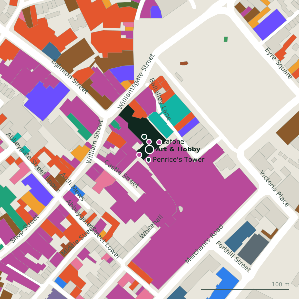
Plan of the surrounding 300 m
Getting to Art & Hobby
- By car
- Park at Eyre Square Centre Car Park on Whitehall, 90 m away, paid, 450 spaces.
- By bus
- The nearest stop is Eyre Square, served by Bus Éireann, 117 m away, with a shelter.
- Directions from where you are
- Open the model above, tap the pin and choose “Directions here”; the route is drawn from your own position.
While you are there
119 places to eat and drink within 300 m: Krispy Kreme (48 m), Insomnia (55 m), The GBC (56 m) and Gatto Rosso (62 m) and more.
140 shops within 300 m, including Vodafone, Corbett Court and NAME IT.
Williamsgate Street itself has 16 named places on the map.
Within a short walk
- Vodafone9 mPhone shops
- Penrice's Tower12 mTowers
- Corbett Court13 mShopping centres
- NAME IT14 mClothes shops
- Over the Moon16 mIce cream
- Jack & Jones17 mClothes shops
- The Edge18 mHairdressers
- Sub City Comics20 mCollector
Also on Williamsgate Street
- 1810 Restaurant and BarRestaurants
- Beef and LobsterRestaurants
- Carraig DonnGift shops
- Carrolls Irish GiftsGift shops
- CoCo ToGoCafés
- Fallers JewellersJewellers
- Hanley & Co.Clothes shops
Everything on Williamsgate Street (16 places)
Other craft shops in Galway
- The Card Shop39 mBallalley Lane
- 1.8 km
- Forget Them Not1.8 kmWestside Enterprise Centre
- Cregal Art Supplies2.8 kmMonivea Road
Questions people ask
Where is Art & Hobby?
How do I contact Art & Hobby?
Are there other craft shops nearby?
Source record: OpenStreetMap node/9703757104, read on 2026-09-18. The street is the mapped address where there is one, otherwise the nearest named road. Distances are straight lines.