Vodafone
Vodafone is a phone shop on Ballalley Lane in Galway, County Galway, 125 m south-west of Eyre Square. Over the Moon, Art & Hobby and NAME IT are within 12 m.
- Kind
- Phone shops
- Street
- Ballalley Lane
- From Eyre Square
- 125 m south-west
- Phone
- +353 91 565 475
- Wheelchair
- Accessible
- Parking
- Eyre Square Centre Car Park on Whitehall, 99 m away
- Bus stop
- Stop, 110 m away
The map does not yet record a website or opening hours for Vodafone. Anyone can add them on OpenStreetMap; this page picks the change up at the next refresh.
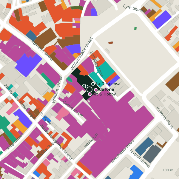
Plan of the surrounding 300 m
Getting to Vodafone
- By car
- Park at Eyre Square Centre Car Park on Whitehall, 99 m away, paid, 450 spaces.
- By bus
- The nearest stop is an unnamed stop, 110 m away, with a shelter.
- Directions from where you are
- Open the model above, tap the pin and choose “Directions here”; the route is drawn from your own position.
While you are there
119 places to eat and drink within 300 m: Krispy Kreme (46 m), The GBC (47 m), Gatto Rosso (57 m) and The Skeff (58 m) and more.
139 shops within 300 m, including Art & Hobby, NAME IT and Corbett Court.
Ballalley Lane itself has 19 named places on the map.
Within a short walk
- Over the Moon8 mIce cream
- Art & Hobby9 mCraft shops
- NAME IT12 mClothes shops
- La Despensa13 mGrocery
- Sub City Comics13 mCollector
- Power Max15 mHealth food
- Timpson17 mLocksmith
- Corbett Court19 mShopping centres
Also on Ballalley Lane
- DieselClothes shops
- DNANightclubs
- Elegant UndiesClothes shops
- Greenes ShoesShoe shops
- InsomniaCafés
- La DespensaGrocery
- MiramiraJewellers
- NAME ITClothes shops
Everything on Ballalley Lane (19 places)
Other phone shops in Galway
- Eir72 mWilliam Street
- 3 Store126 mShop Street
- Phonez N Fix168 mAbbeygate Street Upper
- Mobile Street177 mMerchants Road
- Fonez 4u181 mEyre Square
- WeFix202 mAbbeygate Street Upper
- Vodafone760 mHeadford Road
- HUGMIE809 mHeadford Road
Questions people ask
Where is Vodafone?
How do I contact Vodafone?
Are there other phone shops nearby?
Source record: OpenStreetMap node/9703757105, read on 2026-09-18. The street is the mapped address where there is one, otherwise the nearest named road. Distances are straight lines.