Royal Rock Cafe
Royal Rock Cafe is a café on Bóthar Na Míne in Galway, County Galway, 2.9 km north-east of Eyre Square. Galway Garden Machinery & Motorcycles Ltd, Not New Trading and Central Bearing Supplies Lys are within 27 m.
- Kind
- Cafés
- Street
- Bóthar Na Míne
- From Eyre Square
- 2.9 km north-east
- Bus stop
- Monivea Park (Bus Éireann), 221 m away
The map does not yet record a phone number, a website or opening hours for Royal Rock Cafe. Anyone can add them on OpenStreetMap; this page picks the change up at the next refresh.
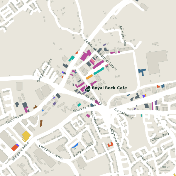
Getting to Royal Rock Cafe
- By bus
- The nearest stop is Monivea Park, served by Bus Éireann, 221 m away.
- Directions from where you are
- Open the model above, tap the pin and choose “Directions here”; the route is drawn from your own position.
While you are there
1 place to eat or drink within 300 m: Supermac's (281 m).
21 shops within 300 m, including Not New Trading, Gannet Fishmongers Ltd and McDonaghs Hardware.
Bóthar Na Míne itself has 23 named places on the map.
Within a short walk
- 16 m
- Not New Trading23 mFurniture
- Central Bearing Supplies Lys27 mMetal construction
- George Signs31 mSignmaker
- Galway Business Equipment32 mStationery
- Auto Electrical Concepts38 mGarages
- Gannet Fishmongers Ltd46 mFishmongers
- McDonaghs Hardware50 mHardware
Also on Bóthar Na Míne
- Austom Galway LtdTrade
- B&C Paint CentrePaint
- Central Bearing Supplies LysMetal construction
- Clearys Loss Assessors & InsuranceInsurance
- DPD - Depot 31 GalwayPost depot
- Eastern ElectricalElectrical
- Elegant Sliding WardrobesFurniture
- Flaherty MarketsElectrical
Everything on Bóthar Na Míne (23 places)
Other cafés in Galway
- Ed's Place722 mBallybrit Business Park
- Cruinniú729 mBallybrit Business Park
- O'Briens974 mMervue Industrial Estate
- Mocha Beans1.4 kmTuam Road
- O'Briens1.4 kmTuam Road
- COCO Café1.4 kmTuam Road
- 1.4 km
- Esquires Coffee1.5 kmWellpark Retail Centre
Questions people ask
Where is Royal Rock Cafe?
Are there other cafés nearby?
Source record: OpenStreetMap node/1734431073, read on 2026-09-18. The street is the mapped address where there is one, otherwise the nearest named road. Distances are straight lines.