Churches · Galway
Saint Columba's Church
Saint Columba's Church is a church in the town in Galway, County Galway, 3.3 km north-east of Eyre Square. Kevin Ryan Windscreens, E Motorcycles and Westwide Panel Beating are within 65 m.
- Kind
- Churches
- From Eyre Square
- 3.3 km north-east
- Bus stop
- Hewlett Packard (Bus Éireann), 518 m away
The map does not yet record a phone number, a website or opening hours for Saint Columba's Church. Anyone can add them on OpenStreetMap; this page picks the change up at the next refresh.
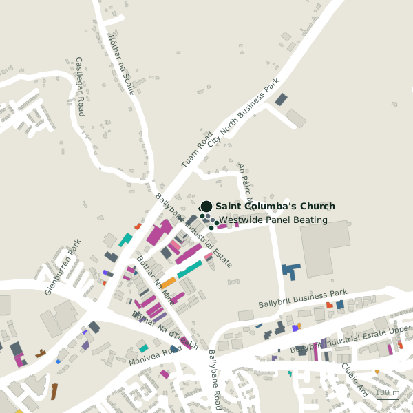
The building in black is this one; drag to turn the model.Open the whole town
Plan of the surrounding 300 m
Getting to Saint Columba's Church
- By bus
- The nearest stop is Hewlett Packard, served by Bus Éireann, 518 m away, with a shelter.
- Directions from where you are
- Open the model above, tap the pin and choose “Directions here”; the route is drawn from your own position.
While you are there
9 shops within 300 m, including Ability West, ACAL Technologies and Elektro Spares & Service.
Within a short walk
- Kevin Ryan Windscreens43 mGarages
- E Motorcycles45 mMotorcycle
- Westwide Panel Beating65 mGarages
- EcoWise Insulation84 mInsulation
- Breathnach Engineering94 mMetal construction
- 96 m
- Ability West104 mCharity shops
- Spectrum Tooling105 mMetal construction
Other churches in Galway
- Lighthouse Assembly Holy Ghost Love Centre360 mGlenrock Business Park
- 532 m
- Christ Embassy Galway574 mBóthar Na dTreabh
- 713 m
- Redeemed Christian Church of God790 mOldenway Business Park
- Discovery Church803 mTuam Road
- Mountain of Fire & Miracles Ministry805 mOldenway Business Park
- Word Alive Bible Ministry827 mOldenway Business Park
Questions people ask
Where is Saint Columba's Church?
In Galway, County Galway, 3.3 km north-east of Eyre Square.
Are there other churches nearby?
40 other churches in $Galway; the closest is Lighthouse Assembly Holy Ghost Love Centre, 360 m away.
Source record: OpenStreetMap way/161600396, read on 2026-09-18. The street is the mapped address where there is one, otherwise the nearest named road. Distances are straight lines.