Screene's on the Square
Screene's on the Square is a pub on Prospect Hill in Galway, County Galway, 127 m north of Eyre Square. Pro Cabs, Snap Fitness and Threshold are within 14 m.
- Kind
- Pubs
- Street
- 9-11 Prospect Hill
- From Eyre Square
- 127 m north
- Wheelchair
- Accessible
- Parking
- Corrib Centre Car Park, 121 m away
- Bus stop
- Eyre Square (Bus Éireann), 71 m away
The map does not yet record a phone number, a website or opening hours for Screene's on the Square. Anyone can add them on OpenStreetMap; this page picks the change up at the next refresh.
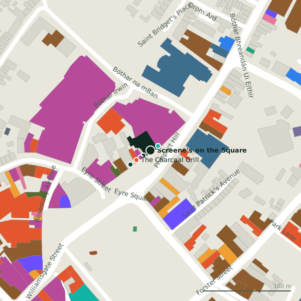
Plan of the surrounding 300 m
Getting to Screene's on the Square
- By car
- Park at Corrib Centre Car Park, 121 m away, paid.
- By bus
- The nearest stop is Eyre Square, served by Bus Éireann, 71 m away, with a shelter.
- Directions from where you are
- Open the model above, tap the pin and choose “Directions here”; the route is drawn from your own position.
While you are there
77 places to eat and drink within 300 m: The Charcoal Grill (19 m), Mary Mullen’s (33 m), Domino's (36 m) and Kennedy’s (38 m) and more.
78 shops within 300 m, including Threshold, TK Maxx and Gala.
Prospect Hill itself has 30 named places on the map.
Within a short walk
- Pro Cabs10 mTaxi ranks
- Snap Fitness10 mGyms
- Threshold14 mCharity shops
- The Charcoal Grill19 mRestaurants
- BoyleSports28 mBookmaker
- Mary Mullen’s33 mBars
- Paddy Power34 mBookmaker
- TK Maxx34 mDepartment stores
Also on Prospect Hill
- Áras an ChontaeCouncil offices
- Armazém BrazilConvenience stores
- Bar One RacingBookmaker
- BeautyphileBeauty
- Bohermore Post OfficePost office
- BoyleSportsBookmaker
- County HallBike hire
- Domino'sTakeaways
Everything on Prospect Hill (30 places)
Other pubs in Galway
- Kennedy’s38 mEyre Square
- Jack J. Foley’s52 mEyre Square
- Fibber Magee’s65 mEyre Square
- The Ol’ 5565 mProspect Hill
- O’Connell’s115 mEyre Square
- An Púcán153 mForster Street
- Murty Rabbit’s155 mForster Street
- 13 On The Green159 mEyre Square
Questions people ask
Where is Screene's on the Square?
Are there other pubs nearby?
Source record: OpenStreetMap node/9939055185, read on 2026-09-18. The street is the mapped address where there is one, otherwise the nearest named road. Distances are straight lines.