St Patrick's Band Society
St Patrick's Band Society is a social centre on Station Road in Galway, County Galway, 246 m east of Eyre Square. Fairgreen Homeless Men's Hostel, Fairgreen and Atlantic Language School are within 73 m.
- Kind
- Social centre
- Street
- Station Road
- From Eyre Square
- 246 m east
- Parking
- Eyre Square Centre Car Park on Whitehall, 324 m away
- Bus stop
- Stop, 55 m away
The map does not yet record a phone number, a website or opening hours for St Patrick's Band Society. Anyone can add them on OpenStreetMap; this page picks the change up at the next refresh.
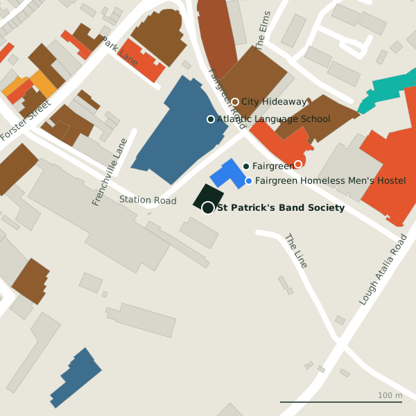
Plan of the surrounding 300 m
Getting to St Patrick's Band Society
- By car
- Park at Eyre Square Centre Car Park on Whitehall, 324 m away, paid, 450 spaces.
- By bus
- The nearest stop is an unnamed stop, 55 m away.
- Directions from where you are
- Open the model above, tap the pin and choose “Directions here”; the route is drawn from your own position.
While you are there
33 places to eat and drink within 300 m: Top Shelf Coffee Bar (82 m), The Boss Doyle’s Bar (139 m), Little Jungle (145 m) and Classico (147 m) and more.
16 shops within 300 m, including Centra, Londis and Penneys.
Within a short walk
- Fairgreen Homeless Men's Hostel40 mSocial services
- Fairgreen46 mBike hire
- Atlantic Language School73 mLanguage school
- Top Shelf Coffee Bar82 mCafés
- City Hideaway89 mHoliday apartments
- Tobin Consulting Engineers97 mEngineers
- Lakeside Apartments101 mHoliday apartments
- Revenue Commissioners111 mGovernment offices
Other social centre in Galway
- Galway Social Space488 mMiddle Street
Questions people ask
Where is St Patrick's Band Society?
Are there other social centre nearby?
Source record: OpenStreetMap way/265824041, read on 2026-09-18. The street is the mapped address where there is one, otherwise the nearest named road. Distances are straight lines.