The Beauty Mint
The Beauty Mint is a cosmetic on Abbeygate Street Lower in Galway, County Galway, 261 m south-west of Eyre Square. BakeBox, Junior Tattoo Studio and Aryan Pizzeria are within 14 m.
- Kind
- Cosmetics
- Street
- Abbeygate Street Lower
- From Eyre Square
- 261 m south-west
- Wheelchair
- Accessible
- Parking
- Eyre Square Centre Car Park on Whitehall, 68 m away
- Bus stop
- Merchants Road (Bus Éireann), 164 m away
The map does not yet record a phone number, a website or opening hours for The Beauty Mint. Anyone can add them on OpenStreetMap; this page picks the change up at the next refresh.
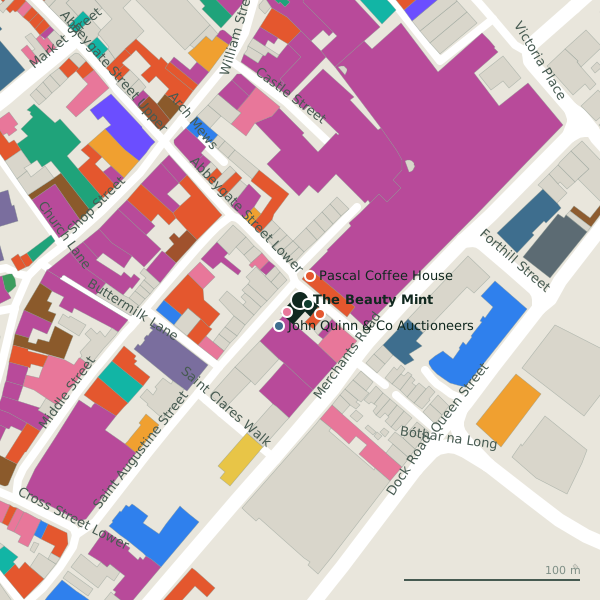
Plan of the surrounding 300 m
Getting to The Beauty Mint
- By car
- Park at Eyre Square Centre Car Park on Whitehall, 68 m away, paid, 450 spaces.
- By bus
- The nearest stop is Merchants Road, served by Bus Éireann, 164 m away.
- Directions from where you are
- Open the model above, tap the pin and choose “Directions here”; the route is drawn from your own position.
While you are there
124 places to eat and drink within 300 m: Aryan Pizzeria (14 m), Pascal Coffee House (14 m), Venice (48 m) and Trieste Café & Wine Bar (58 m) and more.
136 shops within 300 m, including Fresh Cuts, COPE Galway and Iré Island.
Abbeygate Street Lower itself has 18 named places on the map, and 1 car park along it.
Within a short walk
- BakeBox5 mBakeries
- Junior Tattoo Studio10 mTattoo studios
- Aryan Pizzeria14 mTakeaways
- Pascal Coffee House14 mCafés
- John Quinn & Co Auctioneers19 mEstate agents
- Fresh Cuts23 mClothes shops
- COPE Galway25 mCharity shops
- Iré Island26 mGift shops
Also on Abbeygate Street Lower
- Aisling Family BookshopBookshops
- Aryan PizzeriaTakeaways
- BakeBoxBakeries
- Blacoe JewellersJewellers
- Candy CloudConvenience stores
- Fresh CutsClothes shops
- Gourmet Tart Co.Cafés
- H&GHairdressers
Everything on Abbeygate Street Lower (18 places)
Other cosmetics in Galway
- Rituals128 mAbbeygate Street Upper
- L'Occitane229 mEglinton Street
Questions people ask
Where is The Beauty Mint?
Are there other cosmetics nearby?
Source record: OpenStreetMap node/8170958917, read on 2026-09-18. The street is the mapped address where there is one, otherwise the nearest named road. Distances are straight lines.