The Dawson Hostel
The Dawson Hostel is a hostel on Bóthar na mBan in Galway, County Galway, 273 m north of Eyre Square. Crystal Valet, M&S Foodhall and Marks & Spencer are within 73 m.
- Kind
- Hostels
- Street
- Bóthar na mBan
- From Eyre Square
- 273 m north
- Website
- galway.thedawsonhostel.ie
- Wheelchair
- Accessible
- Parking
- Corrib Centre Car Park, 88 m away
- Bus stop
- Woodquay Court (Bus Éireann), 114 m away
The map does not yet record a phone number or opening hours for The Dawson Hostel. Anyone can add them on OpenStreetMap; this page picks the change up at the next refresh.
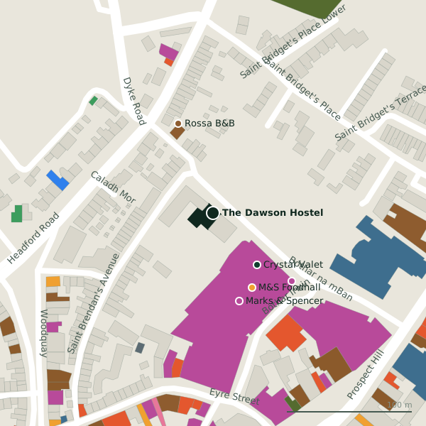
Plan of the surrounding 300 m
Getting to The Dawson Hostel
- By car
- Park at Corrib Centre Car Park, 88 m away, paid.
- By bus
- The nearest stop is Woodquay Court, served by Bus Éireann, 114 m away.
- Directions from where you are
- Open the model above, tap the pin and choose “Directions here”; the route is drawn from your own position.
While you are there
60 places to eat and drink within 300 m: Apoema Bistro (102 m), Yummy Wok (124 m), Renzo (133 m) and Focaccino (150 m) and more.
49 shops within 300 m, including M&S Foodhall, Marks & Spencer and Corrib Shopping Centre.
Bóthar na mBan itself has 2 named places on the map.
Within a short walk
- Crystal Valet54 mCar wash
- M&S Foodhall67 mSupermarkets
- Marks & Spencer73 mDepartment stores
- Rossa B&B77 mGuest houses
- Corrib Shopping Centre83 mShopping centres
- Peter Mark Hair Salon84 mHairdressers
- AIB91 mCash machines
- Carraig Donn98 mInterior decoration
Also on Bóthar na mBan
- Crystal ValetCar wash
Other hostels in Galway
- Woodquay Hostel148 mWoodquay
- Salmon Weir Hostel212 mSaint Vincent's Avenue
- The Savoy Hostel267 mEglinton Street
- Galway City Hostel351 mFrenchville Lane
- Bunk Boutique Hostel369 mForster Street
- Kinlay House393 mVictoria Place
- Snoozles419 mForster Street
- Claddagh Hostel459 mQueen Street
Questions people ask
Where is The Dawson Hostel?
Are there other hostels nearby?
Source record: OpenStreetMap node/1450473314, read on 2026-09-18. The street is the mapped address where there is one, otherwise the nearest named road. Distances are straight lines.