Claddagh Hostel
Claddagh Hostel is a hostel on Queen Street in Galway, County Galway, 186 m south of Eyre Square. VP Motors, The Victoria Hotel and United Methodist Presbyterian Church are within 46 m.
- Kind
- Hostels
- Street
- Queen Street
- From Eyre Square
- 186 m south
- Wheelchair
- Accessible
- Parking
- Eyre Square Centre Car Park on Whitehall, 126 m away
- Bus stop
- Aran Island Ferry Shuttle Bus - Galway City (Aran Island Ferries), 37 m away
The map does not yet record a phone number, a website or opening hours for Claddagh Hostel. Anyone can add them on OpenStreetMap; this page picks the change up at the next refresh.
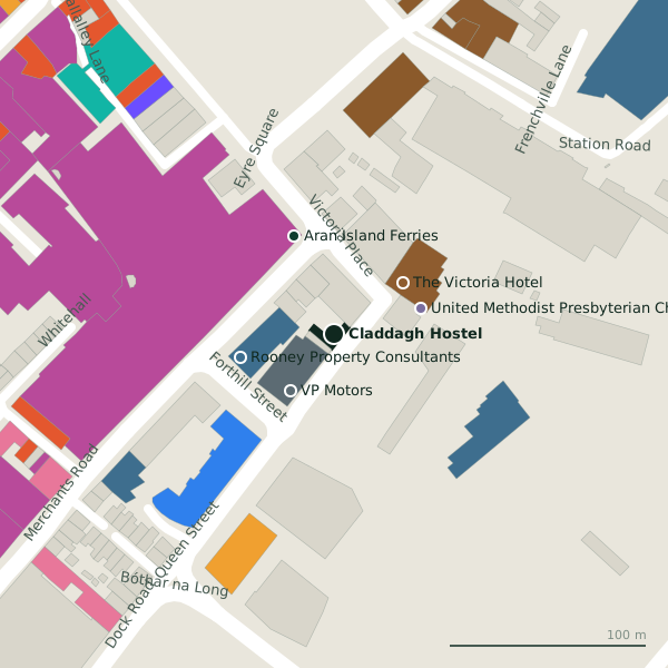
Plan of the surrounding 300 m
Getting to Claddagh Hostel
- By car
- Park at Eyre Square Centre Car Park on Whitehall, 126 m away, paid, 450 spaces.
- By bus
- The nearest stop is Aran Island Ferry Shuttle Bus - Galway City, served by Aran Island Ferries, 37 m away.
- Directions from where you are
- Open the model above, tap the pin and choose “Directions here”; the route is drawn from your own position.
While you are there
65 places to eat and drink within 300 m: Jump Juice (80 m), Costa (107 m), Starbucks (107 m) and Subway (112 m) and more.
87 shops within 300 m, including Penneys, JD Sports and Born.
Queen Street itself has 4 named places on the map, and 1 car park along it.
Within a short walk
- VP Motors37 mGarages
- The Victoria Hotel44 mHotels
- 46 m
- Rooney Property Consultants49 mEstate agents
- Aran Island Ferries54 mVisitor information
- Jigsaw Galway63 mPsychotherapist
- Penneys64 mClothes shops
- Hidden Hearing65 mHearing aids
Also on Queen Street
Other hostels in Galway
- Kinlay House68 mVictoria Place
- Galway City Hostel163 mFrenchville Lane
- Bunk Boutique Hostel247 mForster Street
- The Savoy Hostel302 mEglinton Street
- Snoozles355 mForster Street
- Woodquay Hostel455 mWoodquay
- The Dawson Hostel459 mBóthar na mBan
- Salmon Weir Hostel517 mSaint Vincent's Avenue
Questions people ask
Where is Claddagh Hostel?
Are there other hostels nearby?
Source record: OpenStreetMap node/600494648, read on 2026-09-18. The street is the mapped address where there is one, otherwise the nearest named road. Distances are straight lines.