VP Motors
VP Motors is a garage on Queen Street in Galway, County Galway, 211 m south of Eyre Square. Rooney Property Consultants, Claddagh Hostel and Gate Dental Clinic are within 55 m.
- Kind
- Garages
- Street
- Queen Street
- From Eyre Square
- 211 m south
- Wheelchair
- Accessible
- Parking
- Eyre Square Centre Car Park on Whitehall, 109 m away
- Bus stop
- Merchants Road (Bus Éireann), 67 m away
The map does not yet record a phone number or a website for VP Motors. Anyone can add them on OpenStreetMap; this page picks the change up at the next refresh.
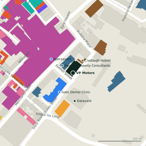
Plan of the surrounding 300 m
Getting to VP Motors
- By car
- Park at Eyre Square Centre Car Park on Whitehall, 109 m away, paid, 450 spaces.
- By bus
- The nearest stop is Merchants Road, served by Bus Éireann, 67 m away.
- Directions from where you are
- Open the model above, tap the pin and choose “Directions here”; the route is drawn from your own position.
While you are there
65 places to eat and drink within 300 m: Jump Juice (77 m), Costa (102 m), Subway (109 m) and Insomnia (116 m) and more.
90 shops within 300 m, including Penneys, Born and JD Sports.
Queen Street itself has 4 named places on the map, and 1 car park along it.
Opening hours
As recorded on the map: Mo-Fr 09:00-17:30, Sa 09:30-14:30
As recorded on OpenStreetMap on 2026-09-18; bank holidays may differ.
Within a short walk
- Rooney Property Consultants30 mEstate agents
- Claddagh Hostel37 mHostels
- Gate Dental Clinic55 mDentists
- Specsavers60 mOpticians
- Datavant65 mCompanies
- Penneys67 mClothes shops
- Born68 mClothes shops
- Jump Juice77 mTakeaways
Also on Queen Street
- Claddagh HostelHostels
- DatavantCompanies
Other garages in Galway
- Farrells Garage403 mSaint Brendan's Avenue
- Kilduff's582 mNun's Island
- BestDrive721 mHeadford Road
- G&P Crash Repairs1.7 kmTuam Road
- Pirtek1.8 kmTuam Road
- Rad Fix Galway1.8 kmTuam Road
- Car Parts Warehouse1.8 kmTuam Road
- Kellehers1.8 kmLower Salthill Road
Questions people ask
Where is VP Motors?
When is VP Motors open?
Are there other garages nearby?
Source record: OpenStreetMap node/1875735684, read on 2026-09-18. The street is the mapped address where there is one, otherwise the nearest named road. Distances are straight lines.