Travelodge
Travelodge is a hotel on Tuam Road in Galway, County Galway, 1.3 km north-east of Eyre Square. Bikram Hot Yoga, DHKN and Bryan S Ryan are within 42 m.
- Kind
- Hotels
- Street
- Tuam Road
- From Eyre Square
- 1.3 km north-east
- Phone
- +353 91 781 400
- Website
- travelodge.ie
- Wheelchair
- Accessible
- Bus stop
- Stop (Bus Éireann), 206 m away
The map does not yet record opening hours for Travelodge. Anyone can add them on OpenStreetMap; this page picks the change up at the next refresh.
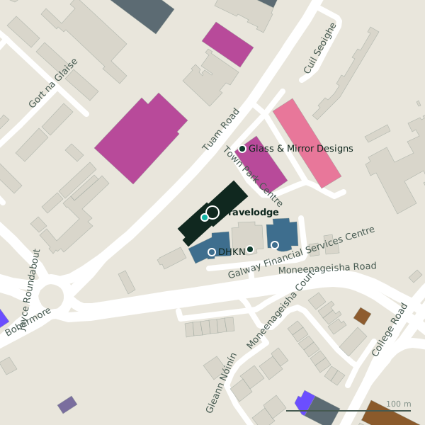
Plan of the surrounding 300 m
Getting to Travelodge
- By bus
- The nearest stop is an unnamed stop, served by Bus Éireann, 206 m away, with a shelter.
- Directions from where you are
- Open the model above, tap the pin and choose “Directions here”; the route is drawn from your own position.
While you are there
4 places to eat and drink within 300 m: Friends Restaurant (105 m), Subway (175 m), The Huntsman Inn (229 m) and Esquires Coffee (298 m).
11 shops within 300 m, including Cane & Rattan Furniture Studio, Ability West and Kingsize Big & Tall Menswear.
Tuam Road itself has 101 named places on the map.
Within a short walk
- Bikram Hot Yoga7 mGyms
- DHKN32 mAccountants
- Bryan S Ryan42 mIT companies
- Glass & Mirror Designs56 mGlaziery
- Murray and Spelman56 mInsurance
- Deacy Gilligan Accountants59 mAccountants
- Cane & Rattan Furniture Studio60 mFurniture
- The Galway Dental Laboratory60 mDentists
Also on Tuam Road
- Ability WestCharity shops
- Ace PrintersPrinter ink
- African Pride StoreConvenience stores
- AIBCash machines
- All 4 BabyBaby goods
- ApplegreenPetrol stations
- Atlantic Print & DesignCopyshop
- Bank of IrelandCash machines
Everything on Tuam Road (101 places)
Other hotels in Galway
- 244 m
- The G297 mDublin Road
- 538 m
- The Urban Nest602 mCollege Road
- Maldron Hotel Sandy Road Galway689 mSandy Road
- St. Judes Lodge B&B Galway769 mCollege Road
- Menlo Park Hotel814 mCoolough Road
- The Dean959 mProspect Hill
Questions people ask
Where is Travelodge?
How do I contact Travelodge?
Are there other hotels nearby?
Source record: OpenStreetMap node/11403668961, read on 2026-09-18. The street is the mapped address where there is one, otherwise the nearest named road. Distances are straight lines.