Westside Community Organic Garden
Westside Community Organic Garden is a garden in the town in Galway, County Galway, 1.7 km west of Eyre Square. Westside Resource Centre, ROBUST and TUSLA West Galway Family Services are within 32 m.
- Kind
- Gardens
- From Eyre Square
- 1.7 km west
- Parking
- Car Park 3, 335 m away
- Bus stop
- Newcastle Resource C (Bus Éireann;City Direct), 98 m away
The map does not yet record a phone number, a website or opening hours for Westside Community Organic Garden. Anyone can add them on OpenStreetMap; this page picks the change up at the next refresh.
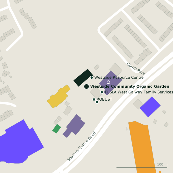
Plan of the surrounding 300 m
Getting to Westside Community Organic Garden
- By car
- Park at Car Park 3, 335 m away, paid.
- By bus
- The nearest stop is Newcastle Resource C, served by Bus Éireann;City Direct, 98 m away, with a shelter.
- Directions from where you are
- Open the model above, tap the pin and choose “Directions here”; the route is drawn from your own position.
While you are there
6 places to eat and drink within 300 m: The Rose Garden Chineese Restaurant & Takeaway (221 m), McDonald's (260 m), Insomnia (262 m) and The Bean Tree (262 m) and more.
14 shops within 300 m, including Centra, Aldi and Mr. Price.
Other sites within 3 km: Corrib Park (124 m), Shantalla Park (277 m), Westside Park (628 m), Sliding Rock (660 m) and Saint Patrick (661 m).
Within a short walk
- Westside Resource Centre20 mCommunity centres
- ROBUST30 mCar hire
- TUSLA West Galway Family Services32 mCommunity centres
- 37 m
- Galway Westside Mosque44 mChurches
- Westside Community Centre66 mCommunity centres
- Westside Public Library74 mLibrary
- Sacred Heart89 mChurches
Questions people ask
Where is Westside Community Organic Garden?
Source record: OpenStreetMap node/13697931184, read on 2026-09-18. The street is the mapped address where there is one, otherwise the nearest named road. Distances are straight lines.