Sacred Heart
Sacred Heart is a church in the town in Galway, County Galway, 1.7 km west of Eyre Square. Corrib Park, Sacred Heart (Seamus Quirke Rd) and Westside Public Library are within 65 m.
- Kind
- Churches
- From Eyre Square
- 1.7 km west
- Wheelchair
- Accessible
- Parking
- Car Park 3, 394 m away
- Bus stop
- Westside Retail (Bus Éireann;City Direct), 67 m away
The map does not yet record a phone number, a website or opening hours for Sacred Heart. Anyone can add them on OpenStreetMap; this page picks the change up at the next refresh.
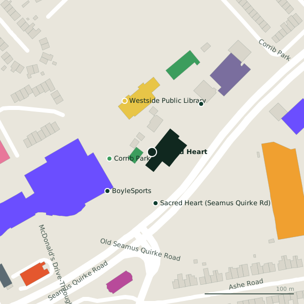
Plan of the surrounding 300 m
Getting to Sacred Heart
- By car
- Park at Car Park 3, 394 m away, paid.
- By bus
- The nearest stop is Westside Retail, served by Bus Éireann;City Direct, 67 m away, with a shelter.
- Directions from where you are
- Open the model above, tap the pin and choose “Directions here”; the route is drawn from your own position.
While you are there
6 places to eat and drink within 300 m: The Rose Garden Chineese Restaurant & Takeaway (143 m), McDonald's (173 m), Domino's (183 m) and Insomnia (185 m) and more.
16 shops within 300 m, including Dunnes Stores, Newsweek and Aldi.
Within a short walk
- Corrib Park48 mParks
- Sacred Heart (Seamus Quirke Rd)58 mBike hire
- Westside Public Library65 mLibrary
- BoyleSports66 mBookmaker
- ROBUST77 mCar hire
- 78 m
- 89 m
- Pat Manogue Park96 mPitches
Other churches in Galway
- 121 m
- Chapel of Saint Columbanus856 mDistillery Road
- Saint Joseph's969 mPresentation Road
- Galway Cathedral1.1 kmGaol Road
- 1.1 km
- Zen dojo1.3 kmDominick Street Lower
- Saint Francis "The Abbey"1.4 kmSaint Francis Street
- Church of Saint Nicholas1.5 kmLombard Street
Questions people ask
Where is Sacred Heart?
Are there other churches nearby?
Source record: OpenStreetMap way/207249789, read on 2026-09-18. The street is the mapped address where there is one, otherwise the nearest named road. Distances are straight lines.