Restaurants · Galway
Zinc Cafe
Zinc Cafe is a restaurant in the town in Galway, County Galway, 1.4 km north-west of Eyre Square. Cairnes Business School, Kingfisher and The Wall Café are within 188 m.
- Kind
- Restaurants
- From Eyre Square
- 1.4 km north-west
- Wheelchair
- Accessible
- Parking
- Car Park 2 on Newcastle Avenue, 679 m away
- Bus stop
- Engineering Building (University of Galway), 69 m away
The map does not yet record a phone number, a website or opening hours for Zinc Cafe. Anyone can add them on OpenStreetMap; this page picks the change up at the next refresh.
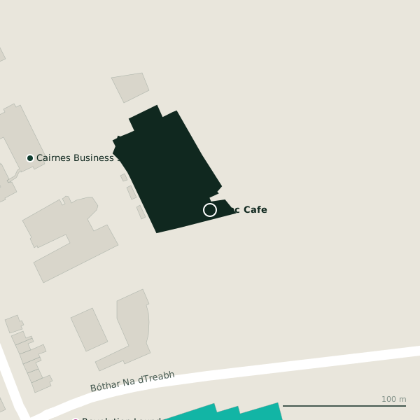
The building in black is this one; drag to turn the model.Open the whole town
Plan of the surrounding 300 m
Getting to Zinc Cafe
- By car
- Park at Car Park 2 on Newcastle Avenue, 679 m away, paid.
- By bus
- The nearest stop is Engineering Building, served by University of Galway, 69 m away, with a shelter.
- Directions from where you are
- Open the model above, tap the pin and choose “Directions here”; the route is drawn from your own position.
While you are there
1 place to eat or drink within 300 m: The Wall Café (188 m).
2 shops within 300 m, including Revolution Laundry and Centra.
Within a short walk
- Cairnes Business School152 mUniversities
- Kingfisher185 mGyms
- The Wall Café188 mCafés
- University of Galway Sports Centre191 mSports centres
- Revolution Laundry203 mLaundries
- Circle K225 mPetrol stations
- Kingfisher, NUIG231 mBike hire
- Bank of Ireland237 mCash machines
Other restaurants in Galway
- An Bhialann457 mMillennium Promenade
- 539 m
- Kawa Asian Street Food841 mNewcastle Road
- Scotty’s851 mCúirt na Coiribe
- Jalan Jalan924 mNewcastle Road
- Nando's1.1 kmHeadford Road
- Franklins Restaurant1.2 kmHeadford Road
- Osteria Italiana Da Simone1.2 kmSaint Francis Street
Questions people ask
Where is Zinc Cafe?
In Galway, County Galway, 1.4 km north-west of Eyre Square; the nearest car park is 679 m away.
Are there other restaurants nearby?
112 other restaurants in $Galway; the closest is An Bhialann, 457 m away.
Source record: OpenStreetMap node/1417111878, read on 2026-09-18. The street is the mapped address where there is one, otherwise the nearest named road. Distances are straight lines.