Hotels · Crowe Street · Gort
Sullivan's Royal Hotel
Sullivan's Royal Hotel is a hotel on Crowe Street in Gort, County Galway, on the Square. The Granary, Brazza and Gallery are within 33 m.
- Kind
- Hotels
- Street
- Crowe Street
- From the Square
- On the Square
- Phone
- +353 91 631257
- Website
- irelandmidwest.com
- Wheelchair
- Not accessible
- Bus stop
- Gort, 36 m away
The map does not yet record opening hours for Sullivan's Royal Hotel. Anyone can add them on OpenStreetMap; this page picks the change up at the next refresh.
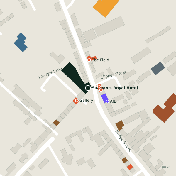
The building in black is this one; drag to turn the model.Open the whole town
Plan of the surrounding 300 m
Getting to Sullivan's Royal Hotel
- By bus
- The nearest stop is Gort, 36 m away, with a shelter.
- Directions from where you are
- Open the model above, tap the pin and choose “Directions here”; the route is drawn from your own position.
While you are there
10 places to eat and drink within 300 m: The Granary (21 m), Brazza (25 m), Gallery (33 m) and The Field (54 m) and more.
2 shops within 300 m, including Lidl and Aldi.
Crowe Street itself has 10 named places on the map.
Within a short walk
- The Granary21 mRestaurants
- Brazza25 mTakeaways
- Gallery33 mCafés
- AIB45 mBanks
- The Field54 mRestaurants
- Gort Garda Station84 mGarda station
- O'Donnells92 mPubs
- Dicey O'Reilly94 mPubs
Also on Crowe Street
- Apache PizzaTakeaways
- BrazzaTakeaways
- Hair HQHairdressers
- Saddler, Lynch & Pierce SolicitorsSolicitors
- SparConvenience stores
- The FieldRestaurants
- The GranaryRestaurants
Everything on Crowe Street (10 places)
Other hotels in Gort
- 720 m
Questions people ask
Where is Sullivan's Royal Hotel?
On Crowe Street in Gort, on the Square.
How do I contact Sullivan's Royal Hotel?
By phone on +353 91 631257, or through irelandmidwest.com.
Are there other hotels nearby?
1 other hotel in $Gort; the closest is Lady Gregory, 720 m away.
Source record: OpenStreetMap node/1315096657, read on 2026-09-18. The street is the mapped address where there is one, otherwise the nearest named road. Distances are straight lines.