County Galway · Connacht · Cill Rícill
About Kilreekil
Kilreekil is a village in County Galway, 40 km east of Galway city. Richill's church, named for a woman said to have known St Patrick, in the barony of Leitrim, with the Turoe Stone and a horse museum in reach and mains water only since 2023.
- Where
- 40 km from Galway, 146 km from Dublin
- Position
- 53.2298° N, 8.4524° W
- In Irish
- Cill Rícill
- On the model
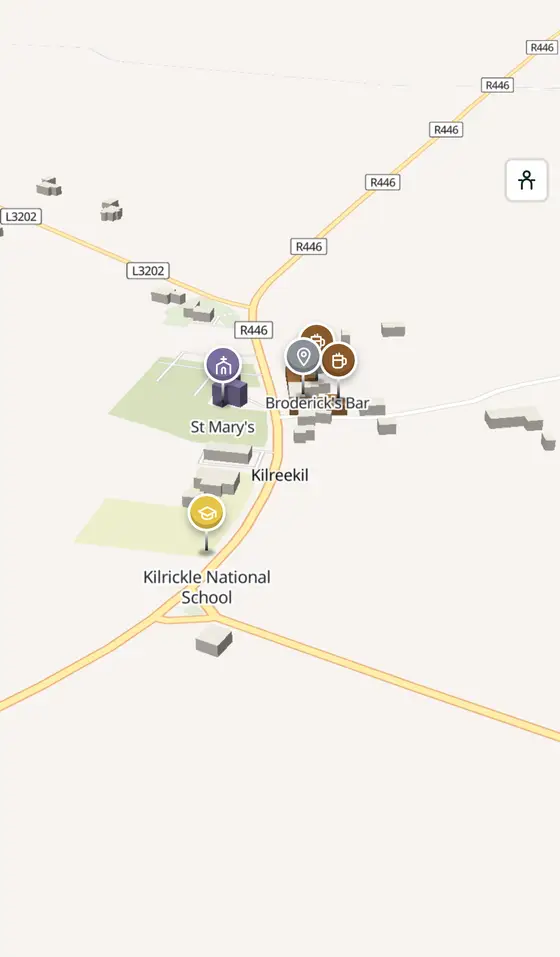
- 90 buildings, 0 streets, 67 places in 15 kinds
- Read more
- Kilreekil on Wikipedia
A short history
- 5th century, in folkloreRichill. A local woman, a contemporary of Patrick, founded a church here; ringforts, souterrains and holy wells lie in Lecarrownagappoge, Dartfield and Wallscourt, where a fortified house also stands.
- About 1820Dartfield House. The country house whose ruins stand in Dartfield.
- 1839Our Lady of Lourdes. The Catholic church in Wallscourt, in the parish of Cappatagle and Kilrickle in the diocese of Clonfert.
- 1922The school. Kilrickle National School was built; it had 56 pupils in 2024.
- 2023Water. The village was joined to the mains water system for the first time in fifty years.
What to see
- Dartfield Horse Museum1.8 km
The museum of the horse, 1.8 km from the village.
- The Turoe Stone7.7 km
The carved Iron Age stone, 7.7 km away.
- Kilcooly3.5 km
The church and castle ruins 3.5 km out.
- Ballybroder Castle4.8 km
The tower house 4.8 km off.
- St Mary's Abbey8.5 km
The abbey ruin 8.5 km away.
Questions people ask
Where is Kilreekil?
In County Galway, in the province of Connacht, in the west of Ireland: 40 km east of Galway city and 146 km west of Dublin, on off the M6 east of Loughrea.
What is there in Kilreekil?
On the map, 67 named places in 15 kinds: 2 places to eat and drink, 0 shops, 3 schools, churches and public buildings, and 62 things to see within 12 km.
What is Kilreekill known for?
Its church of 1839, the Dartfield horse museum, the Turoe Stone nearby, and its people: Jim Fahy, the Hogans and Niamh Regan.
Getting around
Kilreekil sits on off the M6 east of Loughrea. 2 bus stops and 0 car parks are on the map.
History, sights and civic facts summarise Wikipedia, "Kilreekill" (CC BY-SA 4.0, read 2026-09-19). Population is the CSO census as listed there. Distances and everything on the model are OpenStreetMap.