The Burren
Kinvara sits on the Burren's northern edge, where the grey limestone meets Galway Bay, and it is the base for many of the organisations that look after the place. The Burren covers about 530 square kilometres, mostly in Clare but running into Galway around Kinvara and Gort, and the Aran Islands across the bay are the same rock continued. It is one of the finest glacio-karst landscapes in the world and has flowers found nowhere else in Ireland.
Checked against the source on 2026-09-19.
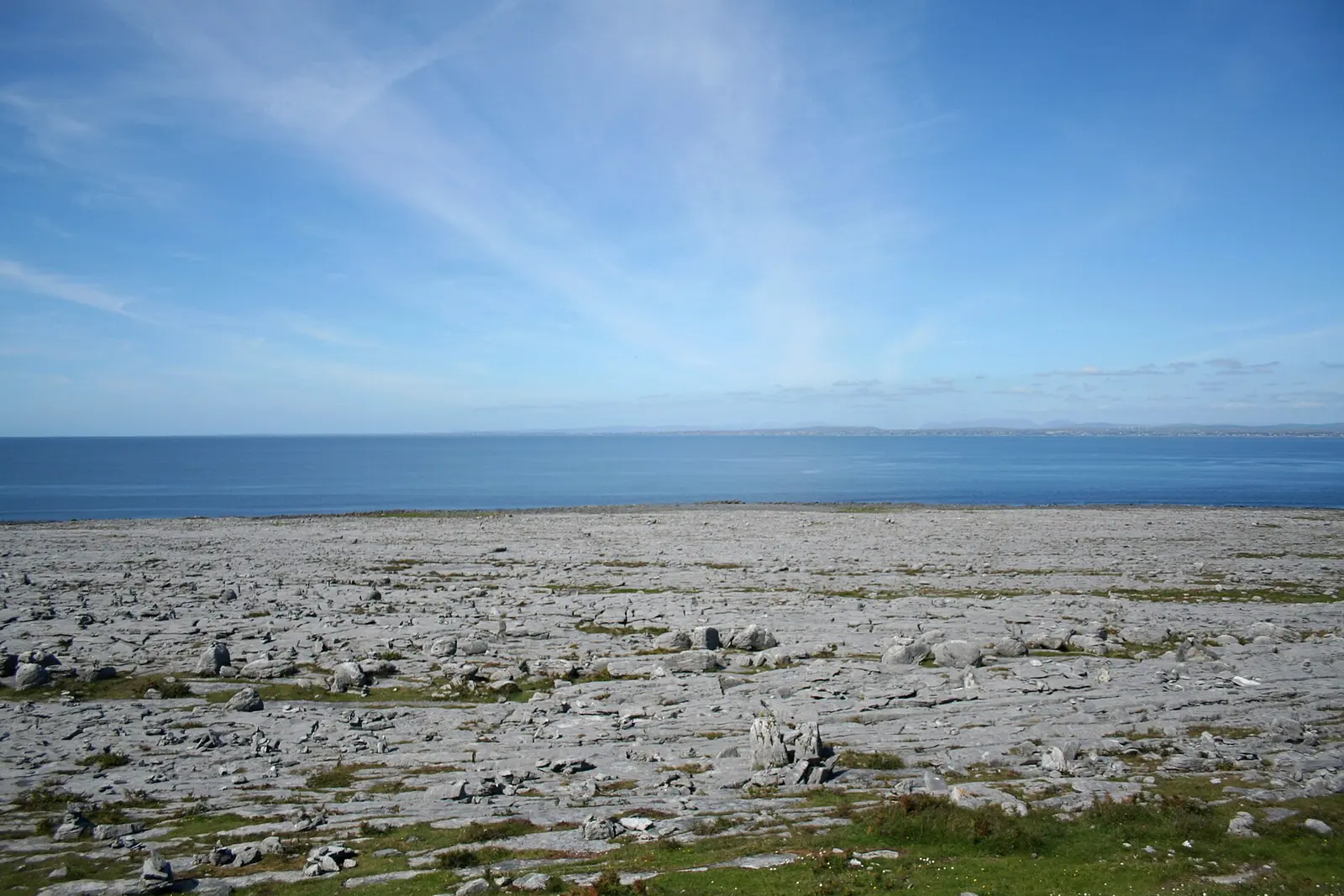
Ingo Mehling, CC BY-SA 3.0 via Wikimedia Commons

Burrenbeo Trust, Dunguaire Castle on the 3D model; tap a pin for its page and directions.
Rock from a tropical sea
The limestones formed as sediment in a tropical sea about 325 million years ago, in the Visean stage of the early Carboniferous, and hold fossil corals, crinoids, sea urchins and ammonites. Ice sheets crossed it several times in the last million years; the final advance reached only the eastern Burren, and the pavement of clints and grikes we see is the work of the Midlandian glaciation and of rain dissolving the stone ever since. Cave finds of butchered bones have been dated to 33,000 years ago, and by the Mesolithic the uplands were wooded with oak, pine and yew.
Seventy per cent of Ireland's flowers
Grass grows once the ground passes 6 °C, and the soil here rarely drops below it, so the Burren has one of the longest growing seasons in Ireland or Britain despite 1,525 millimetres of rain a year. Over 70 per cent of Ireland's flower species grow here, Arctic-alpine and Mediterranean plants together; 23 of the country's 28 orchids are found, all but two of its butterflies and moths, and the Burren green moth lives nowhere else in Ireland. Over 130 lichen stands have been recorded on the pavements. Farmers keep it open by winterage, moving cattle onto the uplands from October to April, a system the BurrenLIFE programme has supported on hundreds of farms.
Tribes, forts and the geopark
The Corco Modhruadh held the district in the Iron Age and early medieval period, and the Brehon law school of the O'Davorans at Cahermacnaghten kept Gaelic learning alive into the early modern period; tower houses such as Newtown and Ballinalacken came only in the fifteenth and sixteenth centuries. The Burren and Cliffs of Moher Geopark, formed in 2011 and recognised by UNESCO the same year, runs from New Quay on Galway Bay south-east to Tubber and round to Doolin; Burren National Park, about 1,500 hectares in the south-east, is the smallest of Ireland's eight. Kinvara is the home of the Burrenbeo Trust, and the model on this page pins it with Dunguaire Castle on the bay.
Questions people ask
Is the Burren in County Galway?
Why does the Burren have so many flowers?
How old is Burren limestone?
What is the Burren Geopark?
Written from Wikipedia, "The Burren" (CC BY-SA 4.0), read on 2026-09-19, and from the OpenStreetMap places on the model. Nothing has been added from memory; follow the source for its footnotes.