Roads, buses, parking
Getting to Mountbellew
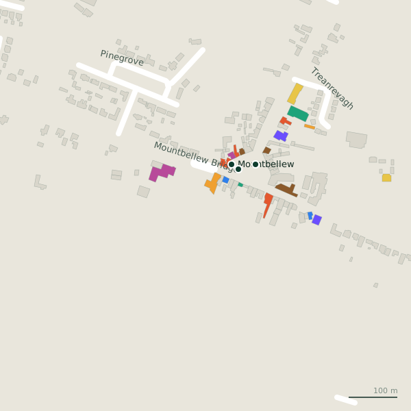
Mountbellew is in County Galway, 42 km north-east of Galway city. Distances below are straight lines from the Square, so the road is a little longer; the bus stops and car parks are the ones on the map.
Cities
- Galway
- 42 km, to the south-west
- Limerick
- 90 km, to the south
- Kilkenny
- 124 km, to the south-east
- Dublin
- 149 km, to the east
- Armagh
- 156 km, to the north-east
- Newry
- 162 km, to the north-east
Airports
- Knock
- 53 km, to the north-west
- Knock
- 54 km, to the north
- Aerphort Chonamara
- 69 km, to the west
- Aerphort Chonamara
- 69 km, to the west
- Aeradróm Inis Oírr
- 81 km, to the south-west
Nearby towns
- Athlone
- 37 km, east
- Mullingar
- 77 km, east
- Ennis
- 77 km, south-west
- Sligo
- 89 km, north
- Portlaoise
- 93 km, south-east
- Newbridge
- 118 km, east
- Navan
- 122 km, east
- Carlow
- 126 km, south-east
- Naas
- 126 km, east
- Maynooth
- 127 km, east
Bus stops
The map records 2 bus stops in Mountbellew. Timetables are not open data; check the operator before you travel.
- MountbellewMountbellew Bridge
- Mountbellew
Parking
1 car park on the map, 1 of them within 600 m of the Square. Capacity and charges are shown only where the map records them.
- Mountbellew Square27 spaces · free · 132 m from the Square
Positions from OpenStreetMap. See it all on the model.